Category:Maps of Northumberland
Wikimedia category | |||||
| Upload media | |||||
| Instance of | |||||
|---|---|---|---|---|---|
| Category combines topics | |||||
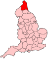
| Northumberland | |||||
ceremonial county and unitary authority area in north east England, UK     | |||||
| Instance of | |||||
| Location |
| ||||
| Legislative body |
| ||||
| Population |
| ||||
| Area |
| ||||
| Replaces |
| ||||
| Different from | |||||
| Said to be the same as | Northumberland (historic county of England, ceremonial county of England, 1844) | ||||
| official website | |||||
 | |||||
Subcategories
This category has the following 13 subcategories, out of 13 total.
A
- Maps of Alnwick (3 F)
D
E
- Election maps of Northumberland (41 F)
F
H
O
R
- Northumberland RJD 1914 (2 F)
W
- Wards of Northumberland (10 F)
Media in category "Maps of Northumberland"
The following 33 files are in this category, out of 33 total.
-

-

-
 England Police Forces (Northumbria).svg 1,108 × 1,345; 312 KB
-
 EnglandPoliceNorthumbria.png 2,165 × 2,670; 87 KB
-
 Holy Island (Overview).jpg 4,512 × 3,024; 7.21 MB
-
 N NE England SRTM.png 1,198 × 1,435; 2.08 MB
-
 NE-belt.svg 1,713 × 1,996; 2.91 MB
-
 Northumber.svg 1,129 × 1,385; 107 KB
-
 Northumberland - British Isles.svg 1,250 × 1,835; 1,002 KB
-
 Northumberland Brit Isles Sect 2.svg 915 × 841; 1,004 KB
-
 Northumberland Brit Isles Sect 3.svg 939 × 677; 972 KB
-
 Northumberland Coast 1954 Composite Map.jpg 19,877 × 32,856; 70.38 MB
-
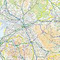
 Northumberland Map.jpg 690 × 850; 130 KB
-
 Northumberland Map.png 4,967 × 4,967; 4.18 MB
-
 Northumberland outline map with UK (2009).png 600 × 714; 219 KB
-
 Northumberland outline map with UK.png 600 × 714; 245 KB
-
 Northumberland UK constituency map (blank).svg 1,120 × 1,345; 926 KB
-
 Northumberland UK district map (blank).svg 1,120 × 1,345; 836 KB
-
 Northumberland UK electoral division map (blank).svg 1,120 × 1,345; 1.49 MB
-
 Northumberland UK electoral division map 2013 (blank).svg 1,120 × 1,345; 1.19 MB
-
 Northumberland UK location map.svg 1,120 × 1,345; 1.68 MB
-
 Northumberland UK locator map 2010.svg 1,108 × 1,345; 302 KB
-
 Northumberland UK parish map (blank).svg 1,120 × 1,345; 2.27 MB
-
 Northumberland UK relief location map.jpg 2,005 × 2,409; 585 KB
-
 NorthumberlandBrit2.PNG 608 × 604; 20 KB
-
 NorthumberlandBrit3.PNG 698 × 491; 19 KB
-
 NorthumberlandNumbered.png 200 × 288; 17 KB
-
 Northumbria terriory (c.802).png 1,155 × 1,500; 118 KB
-
 Ordnance Survey 1-250000 - NU.jpg 4,000 × 4,000; 1.42 MB
-
 Ordnance Survey 1-250000 - NU.tif 4,000 × 4,000; 585 KB
-
 Ordnance Survey 1-250000 - NY.jpg 4,000 × 4,000; 8.08 MB
-
 Ordnance Survey 1-250000 - NZ.jpg 4,000 × 4,000; 5.22 MB
-
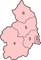
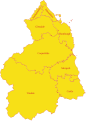 Northumberland Wards.svg 999 × 1,396; 592 KB
.jpg)

.svg)

.jpg)


.png)


.png)


.svg)
.svg)
.svg)
.svg)
.svg)