<nowiki>Category:Maps of Prague-East District; categoría de Wikimedia; kategori Wikimedia; Wikimedia category; د ويکيمېډيا وېشنيزه; Vikimedya kategorisi; ویکیمیڈیا زمرہ; kategória projektov Wikimedia; категорія проєкту Вікімедіа; 维基媒体分类; Wikimedia-Kategorie; Викимедиина категорија; kategorija na Wikimediji; विकिपीडिया:श्रेणी; page de catégorie de Wikimedia; kategorija na Wikimediji; विकिपीडिया वर्ग; категорија на Викимедији; Wikimedia-Kategorie; Wikimedia-kategori; kategori Wikimédia; تصنيف ويكيميديا; pajenn rummata eus Wikimedia; Wikimedia:ကဏ္ဍခွဲခြင်း; 維基媒體分類; Wikimedia категориясы; categoría de Wikimedia; Wikimedia-Kategorie; Викимедиа категорияһы; tudalen categori Wikimedia; kategori e Wikimedias; Վիքիմեդիայի նախագծի կատեգորիա; 维基媒体分类; Wikimedia-kategory; ვიკიპედია:კატეგორიზაცია; ウィキメディアのカテゴリ; categoria Wikimedia; تصنيف بتاع ويكيميديا; විකිමීඩියා ප්රභේද පිටුව; categoria Vicimediorum; विकिमीडिया श्रेणी; Wikimedia-luokka; Wikimedia category; விக்கிமீடியப் பகுப்பு; катэгорыя ў праекце Вікімэдыя; Викимедиа проектындагы төркем; catigurìa di nu pruggettu Wikimedia; หน้าหมวดหมู่วิกิมีเดีย; Wikimedia:Kategorija; Wikimedia-Kategorie; Wikimedia:Klassys; категория на Уикимедия; categorie a unui proiect Wikimedia; 維基媒體分類; Wikimedia-kategori; kawan Wikimèdia; 維基媒體分類; 위키미디어 분류; Wikimedia-bólkur; kategorio en Vikimedio; kategori Wikimedia; Wikimedia:Ronnaghys; উইকিমিডিয়া বিষয়শ্রেণী; kategori Wikimedia; 维基媒体分类; וויקימעדיע קאַטעגאָריע; kategorija w projektach Wikimedije; thể loại Wikimedia; Wikimedia projekta kategorija; kategoria ti Wikimedia; categoria de um projeto da Wikimedia; 维基媒体分类; категорияд Ангилал; Wikimedia-kategori; kategori Wikimedia; پۆلی ویکیمیدیا; Wikimedia category; Vikimédia ñemohenda; Wikimédia-kategória; વિકિપીડિયા શ્રેણી; Wikimediako kategoria; категория в проекте Викимедиа; Wikimedia-Kategorie; катэгорыя ў праекце Вікімедыя; Wikimedia-kategorie; Wîkîmediya:Kategorî; विकिमिडिया श्रेणी; Wikimedia-Kategorie; קטגוריה במיזמי ויקימדיה; Викимедиа проектындагы төркем; Wikimedia-categorie; विकिमिडिया श्रेणी; κατηγορία εγχειρημάτων Wikimedia; Wikimedia-kategoriija; гурӯҳи Викимедиа; categoria de Wikimedia; categoría de Wikimedia; kategoria w projekcie Wikimedia; categoria di un progetto Wikimedia; Wikimedia-categorie; Wikimedia category; categurìa 'e nu pruggette Wikimedia; Wikimedia kategooria; 維基媒體分類; Viciméid catagóir; kategorya ng Wikimedia; гурӯҳи Викимедиа; ẹ̀ka Wikimedia; kategorie na projektech Wikimedia; categoria de um projeto da Wikimedia; Wikimedia-Kategorie; Wikimedia-categorie; tumbung Wikimedia; Wikimedia-kategorie; kategorija Wikimedije; Wikimedia proyektındağı törkem; ردهٔ ویکیپدیا; Wikimedia-kategori; kategori Wikimedia; jamii ya Wikimedia; വിക്കിമീഡിയ വർഗ്ഗം; 維基媒體分類; kategori Wikimedia; Wikimedia-Kategorie; زمرو:وڪيپيڊيا زمرا بندي; Vikipidiya:Shopni; categoría de Wikimedia; Kategoriya ning Wikimedia; 维基媒体分类; guruhi Vikimedia</nowiki>
Subcategories
This category has the following 4 subcategories, out of 4 total.


 Prague-East District 2007 ORP PH CZ.png 954 × 960; 59 KB
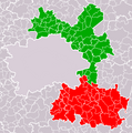
 ORP Brandys nad Labem-Stara Boleslav PH CZ.png 954 × 960; 60 KB
 ORP Ricany PH CZ.png 954 × 960; 59 KB
 Brandýs nad Labem, Ostrůvek.png 578 × 579; 420 KB
 Golf Club Stará Boleslav.jpg 4,032 × 3,024; 3.35 MB
 Husinec (P-V), mapa popisných čísel 2010.jpg 5,184 × 3,888; 6.6 MB
 Informační tabule " Ladův kraj ".jpg 960 × 720; 91 KB
 Karlinsky okres mapa 1850.jpg 5,250 × 6,757; 9.05 MB
 Klecánky, u přívozu, mapa Klecan.jpg 5,184 × 3,888; 5.61 MB
 Krajinou barona Ringhoffera.png 1,040 × 356; 460 KB
 Map CZ - district Praha-vychod.PNG 1,281 × 878; 37 KB
 Máslovická stezka, mapa.jpg 5,184 × 3,888; 6.25 MB
 Okres praha-vychod.png 619 × 356; 19 KB
 Prague-East District 2007 names PH CZ.png 954 × 960; 169 KB
 Velké Popovice, Krajinou barona Ringhoffera.jpg 5,184 × 3,888; 6.21 MB
 Velké Popovice, mapa Ladův kraj.jpg 5,184 × 3,888; 6.24 MB
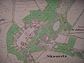 Zamek Skvorec 1841.jpg 2,560 × 1,920; 1.06 MB


,_mapa_popisn%C3%BDch_%C4%8D%C3%ADsel_2010.jpg)


