<nowiki>Category:Maps of Primorsk Oblast; Категория:Карты Приморской области; categoría de Wikimedia; категория на Уикимедия; Vikimedya kategorisi; categurìa 'e nu pruggette Wikimedia; Wikimedia-kategori; категорія проєкту Вікімедіа; kawan Wikimèdia; 維基媒體分類; Wikimedia-Kategorie; 위키미디어 분류; kategorio en Vikimedio; Викимедиина категорија; kategorija na Wikimediji; categoría de Wikimedia; উইকিমিডিয়া বিষয়শ্রেণী; page de catégorie de Wikimedia; kategorija na Wikimediji; וויקימעדיע קאַטעגאָריע; thể loại Wikimedia; Wikimedia projekta kategorija; Wikimedia-kategorie; категорија на Викимедији; categoria de um projeto da Wikimedia; Wikimedia category; Wikimedia-Kategorie; Wikimedia-kategori; Wikimedia-kategori; پۆلی ویکیمیدیا; Wikimedia category; تصنيف ويكيميديا; pajenn rummata eus Wikimedia; 維基媒體分類; Wikimédia-kategória; વિકિપીડિયા શ્રેણી; Wikimediako kategoria; categoría de Wikimedia; Wikimedia-categorie; Викимедиа категорияһы; tudalen categori Wikimedia; kategori e Wikimedias; Վիքիմեդիայի նախագծի կատեգորիա; 维基媒体分类; Wikimedia-kategory; ウィキメディアのカテゴリ; קטגוריה במיזמי ויקימדיה; विकिमीडिया श्रेणी; Wikimedia-luokka; гурӯҳи Викимедиа; Wikimedia-categorie; guruhi Vikimedia; categoria di un progetto Wikimedia; kategoria ti Wikimedia; κατηγορία εγχειρημάτων Wikimedia; катэгорыя ў праекце Вікімэдыя; Wikimedia kategooria; categorie a unui proiect Wikimedia; kategorie na projektech Wikimedia; категория в проекте Викимедиа; ẹ̀ka Wikimedia; Wikimedia-kategori; categoria de um projeto da Wikimedia; Wikimedia категориясы; Wikimedia-kategoriija; tumbung Wikimedia; ردهٔ ویکیپدیا; kategorija Wikimedie; kategoria w projekcie Wikimedia; Wikimedia-Kategorie; Wikimedia-Kategorie; kategori Wikimedia; jamii ya Wikimedia; categoria de Wikimedia; Wikimedia-categorie; kategori Wikimedia; Wikimedia-Kategorie; विकिपीडिया:श्रेणी; катэгорыя ў праекце Вікімедыя; categoría de Wikimedia; kategória projektov Wikimedia; 维基媒体分类; гурӯҳи Викимедиа</nowiki>


.svg)


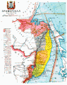 Map of Primorsk Oblast, 1913.gif 984 × 1,245; 524 KB
 Map of Primorsky Oblast.png 4,613 × 5,740; 23.21 MB
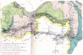 Map of railways in Russia, trans-siberian, 1918.gif 1,423 × 944; 654 KB
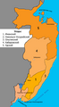 Primorska olb1912.png 543 × 984; 46 KB
 Primorskaya oblast (Russian Empire).jpg 1,748 × 4,164; 428 KB
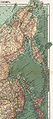 Primorskaya oblast.jpg 2,566 × 5,740; 4.84 MB
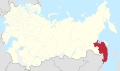 Primorye in Russian Empire (1914).svg 581 × 343; 310 KB
 Yakutsk Amursk Primorye Oblast.jpg 1,171 × 1,009; 185 KB
 Приамурье 1914.jpg 3,981 × 2,586; 2.02 MB

.jpg)


