Category:Maps of Rothaargebirge
Wikimedia category | |||||
| Upload media | |||||
| Instance of | |||||
|---|---|---|---|---|---|
| Category combines topics | |||||
| Rothaar Mountains | |||||
mountain range in North Rhine-Westphalia and Hesse, Germany | |||||
| Instance of | |||||
| Location |
| ||||
| Mountain range | |||||
| Highest point | |||||
| Area |
| ||||
| Elevation above sea level |
| ||||
 | |||||
Media in category "Maps of Rothaargebirge"
The following 18 files are in this category, out of 18 total.
-
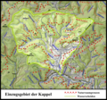
Einzugsgebietskarte Kappel.png 1,512 × 1,409; 3.58 MB
-
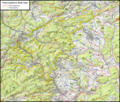
Einzugsgebietskarte Latrop.png 2,229 × 1,474; 5.59 MB
-
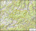
Einzugsgebietskarte Nuhne.png 4,734 × 3,137; 26.56 MB
-
Einzugsgebietskarte Orke.png 4,973 × 4,196; 38.06 MB
-
Einzugsgebietskarte Roespe.png 1,619 × 2,090; 5.88 MB
-
Geology Rothaargebirge.png 2,451 × 3,501; 5.58 MB
-
Karte Naturpark Rothaargebirge.png 750 × 1,000; 201 KB
-
Karte Rothaarsteig.png 718 × 726; 214 KB
-
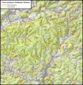
Naturraumkarte Hohe Seite.png 3,338 × 2,849; 17.89 MB
-
Naturraumkarte Hunau gross.png 3,917 × 3,320; 25.68 MB
-
Naturraumkarte Hunau.png 2,843 × 2,199; 12.1 MB
-
Naturraumkarte Kuehhuder Rothaar.png 2,626 × 2,698; 13.49 MB
-
Naturraumkarte Medebacher Bucht und Grafschafter Kammer.png 4,763 × 5,810; 51.55 MB
-
Naturraumkarte Ruesper Rothaar.png 2,604 × 3,181; 15.74 MB
-
Naturraumkarte Ziegenhelle.png 2,706 × 1,958; 9.89 MB
-
Rothaargebirge - Deutsche Mittelgebirge, Serie A-de.png 2,000 × 1,600; 4.59 MB
-
Rothaargebirge.png 188 × 235; 7 KB
-
Übersichtskarte Rothaargebirge.png 556 × 424; 513 KB


