Category:Maps of Saint-Christophe-Vallon
Wikimedia category | |||||
| Upload media | |||||
| Instance of | |||||
|---|---|---|---|---|---|
| Category combines topics | |||||
| Saint-Christophe-Vallon | |||||
commune in Aveyron, France   | |||||
| Instance of | |||||
| Location |
| ||||
| Population |
| ||||
| Area |
| ||||
| Elevation above sea level |
| ||||
| official website | |||||
 | |||||
Subcategories
This category has only the following subcategory.
Media in category "Maps of Saint-Christophe-Vallon"
The following 6 files are in this category, out of 6 total.
-
 12215-Saint-Christophe-Vallon-Arron.png 3,057 × 2,480; 1.25 MB
-
 12215-Saint-Christophe-Vallon-cadastre.svg 961 × 744; 5.78 MB
-
 12215-Saint-Christophe-Vallon-Canton.png 3,057 × 2,480; 1.25 MB
-
 12215-Saint-Christophe-Vallon-EPCI.png 3,057 × 2,480; 1.26 MB
-
 12215-Saint-Christophe-Vallon-Sols.png 3,507 × 2,480; 2.92 MB
-
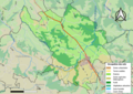
 Map commune FR insee code 12215.png 756 × 605; 55 KB


