Category:Maps of Saint-Cyr-sur-Loire
Wikimedia category | |||||
| Upload media | |||||
| Instance of | |||||
|---|---|---|---|---|---|
| Category combines topics | |||||
| Saint-Cyr-sur-Loire | |||||
commune in Indre-et-Loire, France  .svg)  | |||||
| Pronunciation audio | |||||
| Instance of | |||||
| Named after | |||||
| Location |
| ||||
| Located in or next to body of water | |||||
| Head of government | |||||
| Population |
| ||||
| Area |
| ||||
| Elevation above sea level |
| ||||
| official website | |||||
 | |||||
Subcategories
This category has only the following subcategory.
Media in category "Maps of Saint-Cyr-sur-Loire"
The following 8 files are in this category, out of 8 total.
-
 37214-Saint-Cyr-sur-Loire-argile.png 3,057 × 2,480; 3.82 MB
-
 37214-Saint-Cyr-sur-Loire-Cours eau.jpg 3,507 × 2,480; 710 KB
-
 37214-Saint-Cyr-sur-Loire-Hydro.jpeg 5,846 × 4,133; 3.52 MB
-
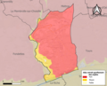
 37214-Saint-Cyr-sur-Loire-Sols.png 3,270 × 2,598; 5.93 MB
-
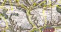 CARTE CASSINI DE SAINT-cYR-sur-Loire.png 532 × 285; 416 KB
-
 Carte levées aménagements Loire - Fondettes.jpg 644 × 385; 82 KB
-
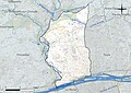
 Map commune FR insee code 37214.png 756 × 605; 79 KB
-
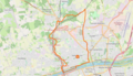 Plan commune Saint-Cyr-sur-Loire openstreetmap.png 971 × 561; 385 KB


