Category:Maps of Saint-Genès-de-Blaye
Wikimedia category | |||||
| Upload media | |||||
| Instance of | |||||
|---|---|---|---|---|---|
| Category combines topics | |||||
| Saint-Genès-de-Blaye | |||||
commune in Gironde, France _mairie.JPG)  | |||||
| Instance of | |||||
| Location |
| ||||
| Population |
| ||||
| Area |
| ||||
| official website | |||||
 | |||||
Media in category "Maps of Saint-Genès-de-Blaye"
The following 7 files are in this category, out of 7 total.
-
 33405-Saint-Genès-de-Blaye-argile.jpg 3,057 × 2,480; 440 KB
-
 33405-Saint-Genès-de-Blaye-relief.png 3,057 × 2,480; 2.03 MB
-
 33405-Saint-Genès-de-Blaye-Routes-Hydro.png 3,507 × 2,480; 1.5 MB
-
 33405-Saint-Genès-de-Blaye-Sols.png 3,270 × 2,598; 1.28 MB
-
 33405-Saint-Genès-de-Blaye-ZNIEFF2.png 5,866 × 4,133; 3.77 MB
-
 Map commune FR insee code 33405.png 756 × 605; 49 KB
-
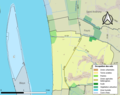
 Saint-Genès-de-Blaye Limite communale.jpg 961 × 579; 141 KB


