Category:Maps of Saint-Hippolyte (Pyrénées-Orientales)
Wikimedia category | |||||
| Upload media | |||||
| Instance of | |||||
|---|---|---|---|---|---|
| Category combines topics | |||||
| Saint-Hippolyte | |||||
French commune in Pyrénées-Orientales, Occitania    | |||||
| Pronunciation audio | |||||
| Instance of | |||||
| Location | |||||
| Head of government |
| ||||
| Population |
| ||||
| Area |
| ||||
| Different from | |||||
| official website | |||||
 | |||||
Media in category "Maps of Saint-Hippolyte (Pyrénées-Orientales)"
The following 9 files are in this category, out of 9 total.
-
 66176-Saint-Hippolyte-argile.png 4,076 × 3,307; 4.31 MB
-
 66176-Saint-Hippolyte-Natura2000.png 5,846 × 4,133; 9.67 MB
-
 66176-Saint-Hippolyte-Routes-Hydro.png 3,507 × 2,480; 755 KB
-
 66176-Saint-Hippolyte-Sols.png 3,270 × 2,598; 2.63 MB
-
 66176-Saint-Hippolyte-ZNIEFF1.png 3,057 × 2,480; 4.66 MB
-
 66176-Saint-Hippolyte-ZNIEFF2.png 3,519 × 2,480; 5.04 MB
-
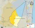
 66176-Saint-Hippolyte-Zone inondable.png 4,677 × 3,307; 6.03 MB
-
 Localització de Sant Hipòlit de la Salanca respecte del Rosselló.svg 487 × 522; 365 KB
-
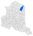
 Map commune FR insee code 66176.png 756 × 605; 82 KB


