Category:Maps of Saint-Pern
Wikimedia category | |||||
| Upload media | |||||
| Instance of | |||||
|---|---|---|---|---|---|
| Category combines topics | |||||
| Saint-Pern | |||||
commune in Ille-et-Vilaine, France  .svg)  | |||||
| Instance of | |||||
| Location |
| ||||
| Capital | |||||
| Population |
| ||||
| Area |
| ||||
| Elevation above sea level |
| ||||
| official website | |||||
 | |||||
Media in category "Maps of Saint-Pern"
The following 3 files are in this category, out of 3 total.
-
 35307-Saint-Pern-Hydro.jpeg 5,846 × 4,133; 2.03 MB
-
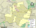 35307-Saint-Pern-Sols.png 3,270 × 2,598; 1.95 MB
-
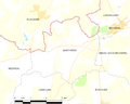 Map commune FR insee code 35307.png 756 × 605; 33 KB

