Category:Maps of Saint-Pompain
Wikimedia category | |||||
| Upload media | |||||
| Instance of | |||||
|---|---|---|---|---|---|
| Category combines topics | |||||
| Saint-Pompain | |||||
commune in Deux-Sèvres, France   | |||||
| Instance of | |||||
| Location |
| ||||
| Population |
| ||||
| Area |
| ||||
| official website | |||||
 | |||||
Subcategories
This category has only the following subcategory.
E
Media in category "Maps of Saint-Pompain"
The following 4 files are in this category, out of 4 total.
-
 79290-Saint-Pompain-argile.jpg 3,057 × 2,480; 617 KB
-
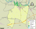
 79290-Saint-Pompain-Hydro.png 3,507 × 2,480; 3.7 MB
-
 79290-Saint-Pompain-Sols.png 3,270 × 2,598; 1.76 MB
-
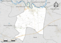
 Map commune FR insee code 79290.png 756 × 605; 52 KB


