Category:Maps of Sainte-Marie-la-Mer
Wikimedia category | |||||
| Upload media | |||||
| Instance of | |||||
|---|---|---|---|---|---|
| Category combines topics | |||||
| Sainte-Marie-la-Mer | |||||
commune in Pyrénées-Orientales, France   | |||||
| Pronunciation audio | |||||
| Instance of | |||||
| Location |
| ||||
| Head of government |
| ||||
| Population |
| ||||
| Area |
| ||||
| Elevation above sea level |
| ||||
| Different from | |||||
| official website | |||||
 | |||||
Media in category "Maps of Sainte-Marie-la-Mer"
The following 9 files are in this category, out of 9 total.
-
 66182-Sainte-Marie-la-Mer-argile.png 4,076 × 3,307; 3.37 MB
-
 66182-Sainte-Marie-la-Mer-Natura2000.png 5,846 × 4,133; 7.07 MB
-
 66182-Sainte-Marie-la-Mer-Routes-Hydro.png 3,507 × 2,480; 636 KB
-
 66182-Sainte-Marie-la-Mer-Sols.png 3,270 × 2,598; 2.45 MB
-
 66182-Sainte-Marie-la-Mer-ZNIEFF1.png 3,057 × 2,480; 3.39 MB
-
 66182-Sainte-Marie-la-Mer-ZNIEFF2.png 3,519 × 2,480; 3.73 MB
-
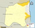
 66182-Sainte-Marie-la-Mer-Zone inondable.png 4,677 × 3,307; 4.12 MB
-
 Localització de Santa Maria la Mar respecte del Rosselló.svg 487 × 522; 365 KB
-
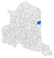
 Map commune FR insee code 66182.png 756 × 605; 40 KB


