Category:Maps of Salt Lake City
Wikimedia category | |||||
| Upload media | |||||
| Instance of | |||||
|---|---|---|---|---|---|
| Category combines topics | |||||
| Salt Lake City | |||||
city in and county seat of Salt Lake County, Utah, United States and the capital of Utah  LDS Church campus in downtown Salt Lake City (Church Office Building, Joseph Smith Memorial Building, the Church Plaza, Salt Lake Temple, Temple Square, Salt Lake Tabernacle) of The Church of Jesus Christ of Latter-day Saints. .svg)  | |||||
| Instance of | |||||
| Named after | |||||
| Location | Salt Lake County, Utah | ||||
| Head of government |
| ||||
| Has part(s) |
| ||||
| Inception |
| ||||
| Population |
| ||||
| Area |
| ||||
| Elevation above sea level |
| ||||
| Different from | |||||
| official website | |||||
 | |||||
Subcategories
This category has the following 2 subcategories, out of 2 total.
P
Media in category "Maps of Salt Lake City"
The following 36 files are in this category, out of 36 total.
-
 634 of 'History of Utah ... 1540-1887. (With a bibliography.)' (11295538283).jpg 1,397 × 1,085; 401 KB
-
 1999 Salt Lake City Tornado path.jpg 702 × 492; 280 KB
-
 After traffic circle TRAX.jpg 200 × 200; 13 KB
-
 Ballpark map.png 256 × 256; 15 KB
-
 Before traffic circle TRAX.jpg 200 × 200; 9 KB
-
 Bird's eye view of Salt Lake City, Utah Territory 1870. LOC 75696611.jpg 10,784 × 8,978; 27.82 MB
-
 Bird's eye view of Salt Lake City, Utah Territory 1870. LOC 75696611.tif 10,784 × 8,978; 277 MB
-
 Birds-eye view of Salt Lake City, Utah 1875. LOC 75696614.jpg 9,881 × 7,312; 12.82 MB
-
 Birds-eye view of Salt Lake City, Utah 1875. LOC 75696614.tif 9,881 × 7,312; 206.71 MB
-
 CtyMapSaltLake.png 936 × 689; 49 KB
-
 DownTown - panoramio.jpg 3,000 × 4,000; 3.64 MB
-
 DowntownSaltLakeCityMap.png 1,904 × 1,232; 59 KB
-
 EB9 Salt Lake City.jpg 535 × 436; 94 KB
-
 Great Salt Lake City Plot C.tif 1,505 × 1,205; 1.75 MB
-
 HogleZooMasterPlan2014.jpg 2,560 × 1,883; 768 KB
-
 Map of Downtown Salt Lake City at City Center, Oct 16.jpg 1,944 × 2,592; 1.51 MB
-
 Map of Hidden Hollow Natural Area, Nov 16.jpg 2,592 × 1,944; 2.24 MB
-
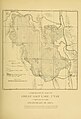 Plate 33 Comparative Map of Great Salt Lake.jpg 1,338 × 1,973; 406 KB
-
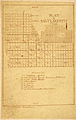 Platslc.jpg 579 × 917; 582 KB
-
 Race and ethnicity 2010- Salt Lake City (5560426192).png 3,009 × 3,009; 2.28 MB
-
 Salt Lake City in 1860 BHoU-p580.png 3,949 × 3,056; 240 KB
-
 Salt Lake City Utah US street map.svg 8,669 × 10,666; 42.94 MB
-
 Salt Lake City, 1887. - DPLA - 5196358103876776daa0e1a33a3e0bf2.jpg 7,000 × 4,642; 5.73 MB
-
 Salt Lake City, UT.png 1,257 × 784; 243 KB
-
 Salt Lake City, Utah - NARA - 85713738.jpg 13,133 × 12,309; 24.94 MB
-
 Salt Lake City, Utah, United States (5461527488).jpg 1,000 × 1,000; 370 KB
-

-
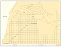
 Saltlakecounty ut.png 800 × 696; 23 KB
-
 SaltLakeMap-updated.png 3,264 × 2,112; 568 KB
-
 SaltLakeMap.png 3,264 × 2,112; 867 KB
-
 Temple Square.svg 1,200 × 750; 10 KB
-
 The Avenues (Salt Lake City) map.png 2,200 × 1,699; 318 KB
-
 UTMap-doton-Salt Lake City.PNG 1,170 × 800; 71 KB
-
 UTMap-doton-SaltLakeCity.PNG 238 × 300; 10 KB
-
 WCNF Wilderness Map.jpg 700 × 513; 91 KB
-
 Wendover locator map.png 500 × 410; 803 KB
%27_(11295538283).jpg)


.png)


.jpg)


_map.png)


