Category:Maps of Sarrebourg
Wikimedia category | |||||
| Upload media | |||||
| Instance of | |||||
|---|---|---|---|---|---|
| Category combines topics | |||||
| Sarrebourg | |||||
French commune in Moselle, Lorraine, Grand Est | |||||
| Instance of | |||||
| Location |
| ||||
| Population |
| ||||
| Area |
| ||||
| Elevation above sea level |
| ||||
| Replaces |
| ||||
| official website | |||||
 | |||||
Subcategories
This category has only the following subcategory.
O
Media in category "Maps of Sarrebourg"
The following 11 files are in this category, out of 11 total.
-
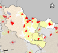
57-AAV2020-Sarrebourg.png 3,519 × 3,197; 2.6 MB
-
57-Sarrebourg-AAV2020.png 3,519 × 2,930; 2.36 MB
-
57-Sarrebruck (partie française)-AAV2020.png 3,519 × 2,930; 955 KB
-
57630-Sarrebourg-Routes-Hydro.png 3,507 × 2,480; 3.47 MB
-
57630-Sarrebourg-Sols.png 3,270 × 2,598; 3.14 MB
-
Arrondissement de Sarrebourg.PNG 850 × 680; 30 KB
-
Bataille de Lorraine d'août et septembre 1914.jpg 1,413 × 992; 630 KB
-
Map commune FR insee code 57630.png 756 × 605; 58 KB
-
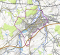
Sarrebourg OSM 01.png 780 × 716; 312 KB
-
Sarrebourg OSM 02.png 780 × 716; 580 KB
-
Tornado Pforzheim.jpg 1,128 × 733; 136 KB


