Category:Maps of Schokland
Wikimedia category | |||||
| Upload media | |||||
| Instance of | |||||
|---|---|---|---|---|---|
| Category combines topics | |||||
| Schokland | |||||
former island in the Dutch Zuiderzee that is located in the municipality Noordoostpolder  The elevation of the former island is clearly visible | |||||
| Instance of | |||||
| Location |
| ||||
| Heritage designation |
| ||||
| Population |
| ||||
| Area |
| ||||
| official website | |||||
 | |||||
Media in category "Maps of Schokland"
The following 29 files are in this category, out of 29 total.
-
 - Topografische kaarten - 30034442 - RCE.jpg 1,200 × 840; 109 KB
-
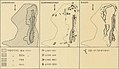
 Bewoningssporen Schokland met legenda.jpg 1,022 × 1,744; 208 KB
-
 Carte détaillée de Schokland 01.jpg 425 × 765; 91 KB
-
 Carte détaillée de Schokland 02.jpg 1,083 × 1,866; 451 KB
-
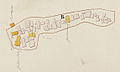
 Detailkaart van Emmeloord.jpg 2,106 × 689; 190 KB
-
 Dijkjes Schokland.jpg 970 × 1,161; 141 KB
-
 Evolution topographie Schokland2.jpg 899 × 520; 89 KB
-
 HET ZAND P13 P14 Schokland.jpg 622 × 434; 29 KB
-
 Kaart van Emmeloord (Schokland).jpg 2,106 × 673; 193 KB
-
-
 Kaart van het eiland Schokland.jpg 11,695 × 7,564; 24.18 MB
-
-
 Kaart van Zuiderbuurt in Schokland.jpg 499 × 295; 25 KB
-
 Kaart vuurtoren Schokland.jpg 422 × 564; 33 KB
-
 Karte von Groningen und Ostfriesland.jpg 10,054 × 5,264; 17.99 MB
-
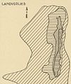
 Landverlies Schokland met legenda.jpg 1,018 × 1,740; 268 KB
-
 Landverlies Schokland.jpg 980 × 1,161; 201 KB
-
 Landverlies-bewoningssporen-dijkjes - nog - 30034341 - RCE.jpg 3,351 × 2,239; 934 KB
-
 Molenbuurt (Ens in Schokland).jpg 1,141 × 682; 101 KB
-
 Mondingen van IJssel en Zwartewater.jpg 2,493 × 1,919; 666 KB
-
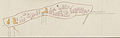
 Rijkswerken op Schokland in den toestand op het einde van 1916.jpg 1,500 × 629; 204 KB
-

-
 Schokland 1600.jpg 555 × 554; 227 KB
-
 Schokland map.svg 1,724 × 3,624; 2.02 MB
-
 Schokland Noordoostplder géoloco.jpg 599 × 410; 38 KB
-
 Schokland unseco heritage.jpg 869 × 508; 52 KB
-
 Schokland-natuur-OpenTopo.jpg 1,144 × 2,200; 610 KB
-
 SchokolandSchokMap.jpg 350 × 590; 45 KB
-
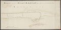
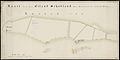
 Situatiekaart van Schokland 1788.jpg 1,000 × 320; 42 KB


.jpg)


.jpg)