Category:Maps of Spree
Wikimedia category | |||||
| Upload media | |||||
| Instance of | |||||
|---|---|---|---|---|---|
| Category combines topics | |||||
| Spree | |||||
river in Germany     | |||||
| Pronunciation audio | |||||
| Instance of | |||||
| Location | |||||
| Connects with | |||||
| Length |
| ||||
| Origin of the watercourse | |||||
| Mouth of the watercourse | |||||
| Drainage basin | |||||
| Basin country | |||||
| Tributary |
| ||||
| Lake on watercourse | |||||
 | |||||
Media in category "Maps of Spree"
The following 27 files are in this category, out of 27 total.
-
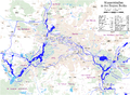
 Berliner Gewässer.png 2,930 × 2,046; 4.21 MB
-
 Berste in LDS.png 299 × 299; 10 KB
-
 Bezirkskarte Charlottenburg-Wilmersdorf 20k farb 2013.pdf 6,141 × 3,425; 11.39 MB
-
 Erpe & Wuhle.png 942 × 1,242; 469 KB
-
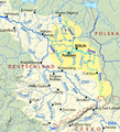
 Fluss Spree in Deutschland.PNG 1,414 × 1,929; 880 KB
-
 Jannowitzbrücke.png 552 × 488; 93 KB
-
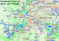
 Karte der Berliner Wasserstraßen.png 3,758 × 2,766; 3.38 MB
-
 Karte des Flusses Spree.gif 501 × 570; 13 KB
-
 Karte des Flusses Spreewald.GIF 501 × 570; 13 KB
-
 Karte Region Berlin (Bearbeitungsvorlage).svg 1,353 × 996; 4.59 MB
-
 Karte vom Lausitzer Seenland.png 1,968 × 1,726; 1.33 MB
-
 Karte2 Spreebogen.JPG 380 × 418; 31 KB
-
 Kleine Spree (Karte des Königreichs Sachsen von 1895).jpg 398 × 631; 64 KB
-
 La Vigne plan of Berlin, Lietzow and Tiergarten.jpg 3,644 × 2,516; 3.57 MB
-

-
 Schmettau Blabbergraben Gesamt.jpg 2,316 × 3,502; 6.09 MB
-
 Schmettau Krumme Spree.jpg 3,802 × 1,896; 5.53 MB
-
 Schmettau Werder (Spree).jpg 1,257 × 1,281; 1.26 MB
-
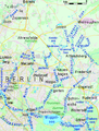
 Seen-suedost-berlin.png 1,711 × 1,580; 120 KB
-
 Spree & Kanäle topo.png 1,540 × 2,468; 5.48 MB
-
 Spree & Kanäle.png 1,540 × 2,467; 3.98 MB
-
 Spree-Havel in Elbe basin, cut.png 787 × 863; 723 KB
-
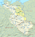 Spree-Havel in Elbe basin.png 1,309 × 1,381; 1.79 MB
-
 Spreeaue zwischen Döbbrik und Schmogrow Map.svg 1,050 × 740; 114 KB
-
 Talsperre-Bautzen-Infotafel.jpg 728 × 468; 72 KB
-
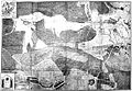
 Urmesstischblatt Preußen 1846 Detail Spreebögen bei Briescht.jpg 3,262 × 1,111; 2.09 MB
-
 Urmesstischblatt Preußen 1846 Detail Werder.jpg 1,219 × 817; 596 KB


.svg)


.jpg)


.jpg)


