Category:Maps of Tieste-Uragnoux
Wikimedia category | |||||
| Upload media | |||||
| Instance of | |||||
|---|---|---|---|---|---|
| Category combines topics | |||||
| Tieste-Uragnoux | |||||
commune in Gers, France .jpg)  | |||||
| Instance of | |||||
| Location |
| ||||
| Located in or next to body of water | |||||
| Population |
| ||||
| Area |
| ||||
 | |||||
Media in category "Maps of Tieste-Uragnoux"
The following 5 files are in this category, out of 5 total.
-
 32445-Tieste-Uragnoux-argile.jpg 3,057 × 2,480; 408 KB
-
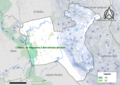 32445-Tieste-Uragnoux-Natura2000.png 5,846 × 4,133; 6.75 MB
-
 32445-Tieste-Uragnoux-Natura2000b.png 5,846 × 4,133; 3.98 MB
-
 32445-Tieste-Uragnoux-ZNIEFF1.jpg 3,519 × 2,480; 511 KB
-
 32445-Tieste-Uragnoux-ZNIEFF2.png 5,866 × 4,133; 3.96 MB


