Category:Maps of Tourriers
Wikimedia category | |||||
| Upload media | |||||
| Instance of | |||||
|---|---|---|---|---|---|
| Category combines topics | |||||
| Tourriers | |||||
commune in Charente, France  .svg)  | |||||
| Instance of | |||||
| Location |
| ||||
| Population |
| ||||
| Area |
| ||||
| official website | |||||
 | |||||
Media in category "Maps of Tourriers"
The following 7 files are in this category, out of 7 total.
-
 16383-Tourriers-argile.jpg 3,057 × 2,480; 565 KB
-
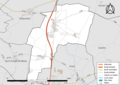 16383-Tourriers-Routes-Hydro.png 3,507 × 2,480; 1.5 MB
-
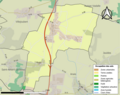
 16383-Tourriers-Routes-Hydro.svg 1,056 × 744; 2.48 MB
-
 16383-Tourriers-Sols.png 3,270 × 2,598; 1.62 MB
-
 16383-Tourriers-ZNIEFF1.png 5,866 × 4,133; 4.23 MB
-
 16383-Tourriers-ZNIEFF2.png 5,866 × 4,133; 4.23 MB
-
 Map commune FR insee code 16383.png 756 × 605; 39 KB


