Category:Maps of Town of Huntington, New York
Use the appropriate category for maps showing all or a large part of Huntington. See subcategories for smaller areas:
| If the map shows | Category to use |
|---|---|
| Huntington on a recently created map | Category:Maps of Town of Huntington, New York or its subcategories |
| Huntington on a map created more than 70 years ago | Category:Old maps of Town of Huntington, New York or its subcategories |
| the history of Huntington on a recently created map | Category:Maps of the history of Town of Huntington, New York or its subcategories |
| the history of Huntington on a map created more than 70 years ago | Category:Old maps of the history of Town of Huntington, New York or its subcategories |
Wikimedia category | |||||
| Upload media | |||||
| Instance of | |||||
|---|---|---|---|---|---|
| Category combines topics | |||||
| Huntington | |||||
town in Suffolk County, New York, United States   | |||||
| Instance of | |||||
| Location | Suffolk County, New York | ||||
| Inception |
| ||||
| Population |
| ||||
| Area |
| ||||
| Elevation above sea level |
| ||||
| official website | |||||
 | |||||
Subcategories
This category has the following 2 subcategories, out of 2 total.
1
- 1946 Huntington Planning Map (12 F)
M
- Maps of Huntington, New York (2 F)
Media in category "Maps of Town of Huntington, New York"
The following 30 files are in this category, out of 30 total.
-

-

-
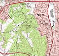 1979-USGS-jayneshill.JPG 793 × 754; 206 KB
-
 Asharoken-ny-map.png 575 × 425; 31 KB
-
 Belle Crest; Melville; Commack NYPL1633988.tiff 7,230 × 4,960; 102.6 MB
-
 Centerport-ny-map.png 575 × 425; 59 KB
-
 Cold-spring-harbor-map.gif 575 × 425; 64 KB
-
 Commack-map.png 575 × 425; 50 KB
-
 Dix-hills-map.png 575 × 425; 66 KB
-
 East-northport-ny-map.png 575 × 425; 64 KB
-
 Eatons-neck-ny-map.png 575 × 425; 40 KB
-
 Elwood-ny-map.png 575 × 425; 67 KB
-
 Fort-salonga-map.gif 575 × 425; 49 KB
-
 Greenlawn-ny-map.gif 575 × 425; 72 KB
-
 Halesite NYPL1633979.tiff 7,230 × 4,960; 102.6 MB
-
 Halesite-map.gif 575 × 425; 50 KB
-
 Huntington-bay-ny-map.gif 575 × 425; 34 KB
-
 Huntington-station-ny-map.gif 575 × 425; 68 KB
-
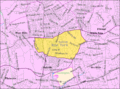
 Huntington-town-map.gif 575 × 425; 77 KB
-

-
 Lloyds-harbor-map.gif 575 × 425; 45 KB
-
 Melville-ny-map.gif 575 × 425; 63 KB
-
 Northport-ny-map.gif 575 × 425; 56 KB
-
 South-huntington-ny-map.gif 575 × 425; 64 KB
-
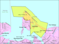
 Suffolk County, NY, towns and villages Asharoken highlighted.svg 963 × 615; 2.15 MB
-
 Suffolk County, NY, towns and villages Huntington Bay highlighted.svg 963 × 615; 2.15 MB
-
 Suffolk County, NY, towns and villages Lloyd Harbor highlighted.svg 963 × 615; 2.15 MB
-
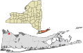 Suffolk County, NY, towns and villages Northport highlighted.svg 963 × 615; 2.15 MB
-

-
 West-hills-ny-map.gif 575 × 425; 65 KB


