Category:Maps of Trieste
Wikimedia category | |||||
| Upload media | |||||
| Instance of | |||||
|---|---|---|---|---|---|
| Category combines topics | |||||
| Trieste | |||||
city and seaport in northeastern Italy | |||||
| Instance of | |||||
| Part of | |||||
| Patron saint | |||||
| Location | |||||
| Official language | |||||
| Population |
| ||||
| Area |
| ||||
| Elevation above sea level |
| ||||
| Different from | |||||
| official website | |||||
 | |||||
Subcategories
This category has the following 4 subcategories, out of 4 total.
O
- Old maps of Trieste (37 F)
P
Media in category "Maps of Trieste"
The following 41 files are in this category, out of 41 total.
-
040 Trieste.png 2,167 × 1,744; 175 KB
-
10 Trieste.png 1,064 × 999; 111 KB
-
Admiralty Chart No 204 Porto Corsini and Otok Premuda to Porto di Trieste, Published 1966.jpg 16,382 × 11,298; 34.72 MB
-
Circoscrizioni-trieste.png 480 × 462; 45 KB
-
Comuni in provinca di TS.JPG 763 × 517; 43 KB
-
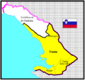
Flag map of Trieste.png 715 × 636; 7 KB
-
Flag map of Trieste.svg 715 × 636; 10 KB
-
FVG wiki 33.JPG 625 × 518; 90 KB
-
Istria 1880.JPG 238 × 213; 27 KB
-
Kaart Italie Triest.png 329 × 353; 19 KB
-
Krain 1794 Pict 1.JPG 907 × 591; 158 KB
-
Krain Tybein 1794.JPG 831 × 575; 156 KB
-
Location map Trieste.jpg 1,883 × 1,730; 648 KB
-
Mappa autostrada Sistiana-Rabuiese.svg 770 × 785; 130 KB
-
Mappa raccordo autostradale RA14.svg 770 × 785; 129 KB
-
Piazza Oberdan, Lageplan 1934.jpg 528 × 799; 201 KB
-
Provincia di Trieste (1923-1945).png 3,443 × 1,689; 442 KB
-
Slovenija-reke-rosandra.png 382 × 668; 56 KB
-
Strada Statale 202 dir mappa.svg 770 × 785; 144 KB
-
Strada Statale 202 mappa.svg 770 × 785; 145 KB
-
Strada Statale 58 mappa.svg 770 × 785; 145 KB
-
Territorio di Trieste 2003 Nord con aggiornamento autostrada e toponomastica 500dpi.jpg 23,405 × 16,555; 45.1 MB
-
Territorio di Trieste 2003 Sud con aggiornamento autostrada e toponomastica 500dpi.jpg 23,405 × 16,555; 51.3 MB
-
Trieste dot.png 1,805 × 2,243; 177 KB
-
Trieste mappa.png 500 × 495; 135 KB
-
Trieste mappa.PNG 500 × 495; 109 KB
-
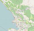
Trieste OSM 01.png 681 × 531; 264 KB
-
Trieste OSM 02.png 681 × 531; 389 KB
-
Trieste sat.png 992 × 654; 1,004 KB
-
Trieste strade.PNG 500 × 495; 104 KB
-
Trieste-province-map.PNG 511 × 388; 42 KB
-
Trieste2003 km grotte strade 20kN 500dpi.jpg 23,405 × 16,555; 44.82 MB
-
Trieste2003 km grotte strade 20kS 500dpi.jpg 23,405 × 16,555; 51.86 MB
-
Trieste2003 muto 500dpi.jpg 23,405 × 16,555; 36.85 MB
-
Trieste2003 mutoB 500dpi.jpg 23,405 × 16,555; 38.47 MB
-
Trieste3d.png 1,022 × 583; 184 KB
-
TriestLocatie.png 134 × 119; 2 KB
-
Trst-zona ab.png 381 × 599; 79 KB
-
Venezia 1494 x Picture.JPG 813 × 498; 44 KB
-
Venezia 1494.JPG 1,009 × 619; 54 KB
