Category:Maps of Varik
Wikimedia category | |||||
| Upload media | |||||
| Instance of | |||||
|---|---|---|---|---|---|
| Category combines topics | |||||
| Varik | |||||
village in West Betuwe, Netherlands   | |||||
| Spoken text audio | |||||
| Instance of | |||||
| Location |
| ||||
| Population |
| ||||
 | |||||
Media in category "Maps of Varik"
The following 3 files are in this category, out of 3 total.
-
 Kaart van de Tielerwaard, met een uitsnede van Varik (1759).jpg 985 × 654; 257 KB
-
 Map NL - Neerijnen - Varik.png 800 × 600; 277 KB
-
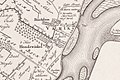
 Varik, Gemeenteatlas van Nederland.jpg 2,180 × 1,680; 4.51 MB
.jpg)
