Category:Maps of Villers-Saint-Genest
Wikimedia category | |||||
| Upload media | |||||
| Instance of | |||||
|---|---|---|---|---|---|
| Category combines topics | |||||
| Villers-Saint-Genest | |||||
commune in Oise, France  .svg)  | |||||
| Instance of | |||||
| Location |
| ||||
| Population |
| ||||
| Area |
| ||||
| official website | |||||
 | |||||
Subcategories
This category has only the following subcategory.
Media in category "Maps of Villers-Saint-Genest"
The following 6 files are in this category, out of 6 total.
-
 60683-Villers-Saint-Genest-Hydro.jpeg 5,846 × 4,133; 986 KB
-
 60683-Villers-Saint-Genest-Sols.png 3,270 × 2,598; 809 KB
-
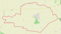
 Map commune FR insee code 60683.png 756 × 605; 26 KB
-
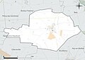
 Villers-Saint-Genest OSM 01.png 987 × 560; 136 KB
-
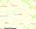
 Villers-Saint-Genest OSM 02.png 987 × 560; 315 KB
-
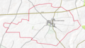
 Villers-Saint-Genest OSM 03.png 707 × 453; 157 KB


