Category:Maps of Vinnytsia Oblast
Regions of Ukraine:
Oblasts: Cherkasy · Chernihiv · Chernivtsi · Dnipropetrovsk · Donetsk · Ivano-Frankivsk · Kharkiv · Kherson · Khmelnytskyi · Kyiv · Kirovohrad · Luhansk · Lviv · Mykolaiv · Odesa · Poltava · Rivne · Sumy · Ternopil · Vinnytsia · Volyn · Zakarpattia · Zaporizhzhia · Zhytomyr – Cities: Kyiv · Sevastopol – Autonomous Republic: Crimea
Oblasts: Cherkasy · Chernihiv · Chernivtsi · Dnipropetrovsk · Donetsk · Ivano-Frankivsk · Kharkiv · Kherson · Khmelnytskyi · Kyiv · Kirovohrad · Luhansk · Lviv · Mykolaiv · Odesa · Poltava · Rivne · Sumy · Ternopil · Vinnytsia · Volyn · Zakarpattia · Zaporizhzhia · Zhytomyr – Cities: Kyiv · Sevastopol – Autonomous Republic: Crimea
Wikimedia category | |||||
| Upload media | |||||
| Instance of | |||||
|---|---|---|---|---|---|
| Category combines topics | |||||
| Vinnytsia Oblast | |||||
administrative division (oblast) in center of Ukraine | |||||
| Instance of | |||||
| Location |
| ||||
| Capital | |||||
| Head of government |
| ||||
| Inception |
| ||||
| Population |
| ||||
| Area |
| ||||
| official website | |||||
 | |||||
Subcategories
This category has the following 3 subcategories, out of 3 total.
Media in category "Maps of Vinnytsia Oblast"
The following 32 files are in this category, out of 32 total.
-
Chmelnikskiy rayon 2020.png 533 × 562; 44 KB
-
Gaisinskiy rayon 2020.png 533 × 562; 44 KB
-
Gaisinskiy Rayon 2020.svg 533 × 562; 55 KB
-
Khmelnikskiy Rayon 2020.svg 533 × 562; 54 KB
-
Lenin map Yampil.png 845 × 980; 347 KB
-
Locator map of Vinnytsa province.svg 887 × 589; 544 KB
-
Map of Ukraine political Podilskyi raion.png 800 × 559; 155 KB
-
Map of Ukraine political simple Oblast Wynnyzja.png 2,466 × 1,749; 282 KB
-
Map.78.png 802 × 542; 1,005 KB
-
Mapa bershad region.jpg 1,600 × 1,338; 395 KB
-
Mogiljov-Podolskiy rayon 2020.png 533 × 562; 44 KB
-
Mogiljov-Podolskiy Rayon 2020.svg 533 × 562; 54 KB
-
Piesczanka.GIF 940 × 523; 156 KB
-
Teplik.GIF 941 × 510; 175 KB
-
Trybusowka.gif 1,413 × 642; 395 KB
-
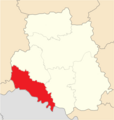
Tulchinskiy rayon 2020.png 533 × 562; 44 KB
-
Tulchinskiy Rayon 2020.svg 533 × 562; 55 KB
-
Ukraine. Braclavia Palatinatus. Beauplan Elins.jpg 1,551 × 811; 541 KB
-
UPA-structure.PNG 780 × 570; 498 KB
-
Vinnickiy rayon 2020.png 533 × 562; 44 KB
-
Vinnickiy Rayon 2020.svg 533 × 562; 56 KB
-
Vinnitskiy Economic Administrative Region - DPLA - 660503b71544d570ee843d20ef2b765a.jpg 9,516 × 7,527; 7.7 MB
-
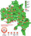
Vinnytsia Oblast 2020 subdivisions.jpg 1,410 × 997; 164 KB
-
Vinnytsia oblast detail map.png 341 × 379; 21 KB
-
Vinnytsia Oblast in Ukraine (de jure).svg 1,547 × 1,041; 716 KB
-
Vinnytsya Ukraine.png 8,002 × 4,500; 3.47 MB
-
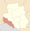
Zhmerinskiy rayon 2020.png 533 × 562; 44 KB
-
Zhmerinskiy Rayon 2020.svg 533 × 562; 54 KB
-
Печера.png 640 × 447; 115 KB
-
Стіна топоніми.jpg 1,185 × 855; 761 KB
-
Фрагмент Карти України Гійома де Боплана, 1650р.jpg 773 × 616; 216 KB


