Category:Maps of ancient Roman roads in Belgium
Media in category "Maps of ancient Roman roads in Belgium"
The following 19 files are in this category, out of 19 total.
-
 Atuatuca.PNG 435 × 497; 257 KB
-
 Bavay - Dinant.svg 600 × 108; 21 KB
-
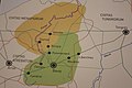
 Bavay - Gembloux 2.svg 600 × 332; 63 KB
-
 Bavay - Gembloux.svg 600 × 332; 62 KB
-
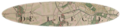
 Chaussée Brunehault IGN(46 5) 1882.jpg 1,497 × 1,056; 657 KB
-
 Espace gallo-romain de Ath 34.jpg 3,648 × 5,472; 8.98 MB
-
 Espace gallo-romain de Ath 35.jpg 5,472 × 3,648; 8.92 MB
-
 ForHadriani.PNG 435 × 497; 257 KB
-
 Germania inferior roads towns.png 1,162 × 1,134; 1.83 MB
-
 Germanie-inferieure.jpg 1,149 × 1,125; 1.62 MB
-
 Kaart heirwegen elewijt 2.jpg 665 × 246; 49 KB
-
 Roman road Maastricht-Nijmegen (Ferraris).png 1,846 × 428; 1.08 MB
-
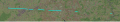
 Roman road Maastricht-Nijmegen.png 586 × 173; 193 KB
-
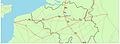
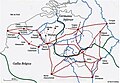
 Roman roads in Belgium.jpg 2,434 × 1,553; 279 KB
-
 Romeinsche oudheden te Maastricht, plaat 1, RP-P-1908-291.jpg 3,716 × 5,706; 2.02 MB
-
 Réseau routier gallo-romain.jpg 1,076 × 748; 441 KB
-
 Tongeren - Gembloux.svg 600 × 300; 71 KB
-
 Tongeren - Herstal.svg 600 × 600; 84 KB
-
 Via Belgica-kaart.png 600 × 223; 15 KB


_1882.jpg)


.png)