Category:Maps of beltways
Subcategories
This category has the following 14 subcategories, out of 14 total.
B
- Maps of beltways in Belgium (34 F)
C
F
G
I
- Maps of beltways in Italy (50 F)
J
M
N
P
- Maps of beltways in Poland (19 F)
R
- Ring road maps of Sofia (4 F)
- Maps of beltways in Russia (17 F)
S
Media in category "Maps of beltways"
The following 21 files are in this category, out of 21 total.
-
Anthony Henday Drive Map.png 1,480 × 962; 164 KB
-
Finland national road 40.png 455 × 800; 110 KB
-
Finland national road 50.png 455 × 800; 109 KB
-
Inner-outer-left-hand-traffic.svg 360 × 360; 2 KB
-
Inner-outer-right-hand-traffic.svg 360 × 360; 2 KB
-
Kantatie 40 Turku region.svg 840 × 595; 440 KB
-
Karte H3 SI.svg 1,840 × 1,200; 28 KB
-
Kehä III and Kuninkaantie composite map.svg 4,200 × 2,100; 2.5 MB
-
OSM Circuvalación Americo Vespucio.png 896 × 730; 957 KB
-
Plano de castellon 2.png 2,968 × 2,564; 795 KB
-
Plànol de Castelló mut.png 3,072 × 2,649; 720 KB
-
Rodoanel Mário Covas.svg 512 × 374; 5.29 MB
-
RodoanelSP.JPG 728 × 587; 63 KB
-
Santa Clara Beltway (OpenStreetMap).png 1,033 × 577; 566 KB
-
Shanghai Inner Ring Road map.svg 963 × 1,163; 77 KB
-
Slovenia - H3.svg 1,249 × 845; 49 KB
-
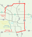
Stoney Trail Calgary 2017.png 1,484 × 1,692; 189 KB
-
Stoney Trail Calgary 2020.png 1,445 × 1,645; 179 KB
-
Stoney Trail Calgary 2021.png 1,445 × 1,645; 170 KB
-
Sydney-orbital-black-line.png 2,333 × 1,711; 6.79 MB
-
TW PHW74route.svg 240 × 180; 225 KB


