Category:Maps of borders of France
Subcategories
This category has only the following subcategory.
Media in category "Maps of borders of France"
The following 59 files are in this category, out of 59 total.
-
 462 of 'La France Illustrée- géographie générale ... Par F. J' (11293558535).jpg 1,271 × 1,248; 428 KB
-
 Alsace Lorraine departments evolution map-de.svg 600 × 450; 390 KB
-
 Alsace Lorraine departments evolution map-en.svg 600 × 450; 91 KB
-
 Alsace Lorraine departments evolution map-es.svg 600 × 450; 98 KB
-
 Alsace Lorraine departments evolution map-fr.svg 600 × 450; 98 KB
-
 Alsace Lorraine departments evolution map-hu.svg 600 × 450; 99 KB
-
 Alsace Lorraine departments evolution map-lb.svg 600 × 450; 98 KB
-
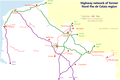 Auto rézo 59-62.png 1,502 × 1,000; 121 KB
-
 Border-Brazil-France-es.svg 494 × 575; 213 KB
-
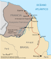
 Border-Brazil-France.svg 494 × 575; 26 KB
-
 Caribbean maritime boundaries map zh.svg 3,561 × 2,221; 2.87 MB
-
 Caribbean maritime boundaries map.svg 3,561 × 2,221; 2.78 MB
-
 Caribbean maritime boundaries map mk.svg 3,561 × 2,221; 5.52 MB
-
 Mapa das Caraíbas (fronteiras marítimas).svg 3,561 × 2,221; 2.86 MB
-
 Mapa del Caribe (límites marinos).svg 5,340 × 3,660; 3.02 MB
-
 Mapa del Mar Caribe (límites marinos)-fr.svg 3,587 × 2,221; 1.91 MB
-
 Mapa del Mar Caribe (límites marinos).svg 3,587 × 2,221; 1.98 MB
-
 Carte ferro B-FC.png 1,472 × 1,166; 307 KB
-
 Carte ferro Fra E.png 1,527 × 1,764; 452 KB
-
 Carte ferro Fra N.png 1,526 × 1,275; 299 KB
-
 Alsace Lorraine departments evolution map-cs.svg 600 × 450; 303 KB
-

-
 Evolution of Franco-Italian border.jpg 1,009 × 1,470; 170 KB
-
 France-Italy border 2.jpg 2,130 × 2,867; 1.35 MB
-
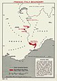 France-Italy border.jpg 1,967 × 2,789; 523 KB
-
 France-Switzerland border 1.jpg 708 × 936; 133 KB
-
 France-Switzerland border 3.jpg 1,398 × 928; 194 KB
-
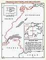
 France-Switzerland border map 2.jpg 2,026 × 930; 208 KB
-
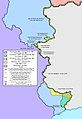
 Frontières entre la France et le Vénézuela.svg 1,940 × 1,424; 1.16 MB
-
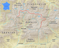
 Grenzverlauf CH F.png 2,431 × 2,922; 10.13 MB
-
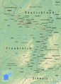 Grenzverlauf D-F.png 2,294 × 3,185; 10.61 MB
-
 Grenzverlauf F-AND.png 2,087 × 1,685; 2.26 MB
-
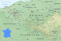 Grenzverlauf F-B.png 2,991 × 2,003; 7.59 MB
-
 Grenzverlauf F-BRA.png 3,223 × 2,701; 12.02 MB
-
 Grenzverlauf F-E.png 3,540 × 2,266; 10.08 MB
-
 Grenzverlauf F-I.png 1,472 × 2,554; 5.04 MB
-
 Grenzverlauf F-LUX.png 2,275 × 1,714; 3.61 MB
-
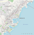 Grenzverlauf F-MC.png 2,516 × 2,586; 2.85 MB
-
 Grenzverlauf F-SME.png 3,599 × 3,335; 17.35 MB
-
 Límites marítimos de Venezuela.png 732 × 558; 22 KB
-
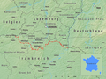
 Maritime border Monaco.png 1,076 × 717; 801 KB
-
 Maritime boundaries between Comoros and France-fr.svg 2,208 × 1,572; 772 KB
-
 Maritime boundaries between Seychelles and France-fr.svg 2,208 × 1,572; 770 KB
-
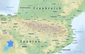
 Pyrenees map shaded relief-fr.svg 3,200 × 1,900; 5.58 MB
-
 Pyrenees topographic map-ca.svg 3,200 × 1,900; 6.27 MB
-
 Pyrenees topographic map-de.svg 3,200 × 1,900; 6.3 MB
-
 Pyrenees topographic map-en.svg 3,200 × 1,900; 6.3 MB
-
 Pyrenees topographic map-eo.svg 3,200 × 1,900; 6.01 MB
-
 Pyrenees topographic map-es.svg 3,200 × 1,900; 6.15 MB
-
 Pyrenees topographic map-fr.svg 3,200 × 1,900; 6.3 MB
-
 Pyrenees topographic map-it.svg 3,200 × 1,900; 6.3 MB
-
 Pyrenees topographic map-mk.svg 3,200 × 1,900; 7.54 MB
-
 Pyrenees topographic map-pl.svg 3,200 × 1,900; 6.31 MB
-
 Pyrenees topographic map-ru.svg 3,200 × 1,900; 6.3 MB
-
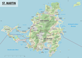 St. Martin.png 5,563 × 3,938; 6.29 MB
-
 Traité de Francfort-es.svg 744 × 1,052; 51 KB
-
 Traité de Francfort-pt.svg 744 × 1,052; 51 KB
-
 Traité de Francfort.svg 744 × 1,052; 51 KB
-
 Welschinger-La Protestation-3.jpg 4,180 × 6,039; 8.99 MB
.jpg)


.svg)
.svg)
-fr.svg)
.svg)


