Category:Maps of borders of Germany
Countries of Europe: Armenia‡ · Austria · Azerbaijan‡ · Belgium · Bulgaria · Croatia · Cyprus‡ · Denmark · Finland · France‡ · Germany · Greece · Hungary · Italy · Netherlands‡ · North Macedonia · Norway · Poland · Romania · Russia‡ · Slovakia · Slovenia · Spain‡ · Sweden · Switzerland · Turkey‡ · Ukraine · United Kingdom
‡: partly located in Europe
‡: partly located in Europe
Subcategories
This category has only the following subcategory.
M
Media in category "Maps of borders of Germany"
The following 39 files are in this category, out of 39 total.
-
 Alsace Lorraine departments evolution map-de.svg 600 × 450; 390 KB
-
 Alsace Lorraine departments evolution map-en.svg 600 × 450; 91 KB
-
 Alsace Lorraine departments evolution map-es.svg 600 × 450; 98 KB
-
 Alsace Lorraine departments evolution map-fr.svg 600 × 450; 98 KB
-
 Alsace Lorraine departments evolution map-hu.svg 600 × 450; 99 KB
-
 Alsace Lorraine departments evolution map-lb.svg 600 × 450; 98 KB
-
 Belgium-Germany border close-up A.jpg 1,372 × 769; 396 KB
-
 Belgium-Germany border close-up B.jpg 1,589 × 1,038; 612 KB
-
 Belgium-Germany border close-up C.jpg 1,004 × 1,548; 592 KB
-
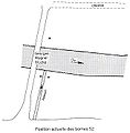 Borne 52 - Allemagne-Luxembourg-Belgique.jpg 650 × 660; 59 KB
-
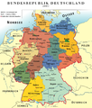 BRD.png 2,152 × 2,537; 928 KB
-
 Carte-évasion-Cioma-Schönhaus.jpg 848 × 1,018; 153 KB
-
 Alsace Lorraine departments evolution map-cs.svg 600 × 450; 303 KB
-
 Denmark-Germany border.png 974 × 1,230; 167 KB
-
 Frontiere Borne Luxembourg-Allemagne.jpg 664 × 1,044; 68 KB
-
 Frontiere Luxembourgois-Prusse - Moselle avec le Poteau 1.jpg 576 × 1,080; 45 KB
-
 Germany-Netherlands border 2.jpg 1,148 × 884; 246 KB
-
 Germany-Netherlands border.jpg 647 × 809; 185 KB
-
 Granica polsko-niemiecka 1920-1938.png 557 × 539; 16 KB
-
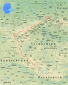
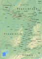
 Grenzverlauf CH D.png 2,273 × 811; 2.79 MB
-
 Grenzverlauf D-A.png 2,782 × 1,810; 7.31 MB
-
 Grenzverlauf D-B.png 2,465 × 1,942; 5.63 MB
-
 Grenzverlauf D-CZ.png 2,283 × 2,818; 9.86 MB
-
 Grenzverlauf D-DK.png 2,419 × 1,354; 3.67 MB
-
 Grenzverlauf D-F.png 2,294 × 3,185; 10.61 MB
-
 Grenzverlauf D-LUX.png 2,016 × 2,537; 5.4 MB
-
 Grenzverlauf D-NL.png 1,404 × 2,584; 5.23 MB
-
 Grenzverlauf D-P.png 2,292 × 3,976; 11.99 MB
-
 Jezioro Nowowarpienskie small map 2007 PL.png 600 × 524; 69 KB
-
 Karte Divisionsstandorte des Deutschen Heers 1914.png 2,710 × 2,271; 859 KB
-

-
-
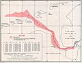
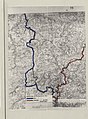
 Map of the Belgian-German border 1949-1958.png 1,048 × 2,363; 1.39 MB
-
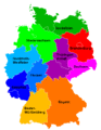 Neugliederungsvorschlag mit 10 Länder nur-Fussionen.gif 500 × 646; 15 KB
-
 Traité de Francfort-es.svg 744 × 1,052; 51 KB
-
 Traité de Francfort-pt.svg 744 × 1,052; 51 KB
-
 Traité de Francfort.svg 744 × 1,052; 51 KB
-
 UsedomWolin.png 543 × 419; 12 KB
-
 Welschinger-La Protestation-3.jpg 4,180 × 6,039; 8.99 MB


_(Bundesarchiv_Koblenz_R_43_II_1404_a_0197).jpg)
_(Bundesarchiv_Koblenz_R_43_II_1404_a_0199).jpg)


