Category:Maps of borders of the Democratic Republic of the Congo
Countries of Africa: Algeria · Angola · Botswana · Burkina Faso · Burundi · Cameroon · Central African Republic · Chad · Democratic Republic of the Congo · Republic of the Congo · Djibouti · Egypt‡ · Eswatini · Ethiopia · Gabon · Ghana · Guinea · Guinea-Bissau · Ivory Coast · Kenya · Lesotho · Liberia · Libya · Malawi · Mali · Mauritania · Morocco · Mozambique · Namibia · Niger · Nigeria · Rwanda · Senegal · Sierra Leone · Somalia · South Africa · South Sudan · Sudan · Tanzania · Togo · Tunisia · Uganda · Zambia · Zimbabwe
Limited recognition: Ambazonia · Somaliland – Other areas: Western Sahara
‡: partly located in Africa
Limited recognition: Ambazonia · Somaliland – Other areas: Western Sahara
‡: partly located in Africa
Media in category "Maps of borders of the Democratic Republic of the Congo"
The following 15 files are in this category, out of 15 total.
-
 Angola-South-West Africa boundary. LOC 84692090.tif 5,721 × 4,136; 67.7 MB
-
 Angola-Zaire Boundary.jpg 3,166 × 2,274; 2.36 MB
-
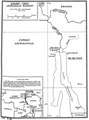 Burundi-DRC border.png 842 × 1,140; 282 KB
-
 Central African Republic-Congo (Kinshasa) boundary. LOC 85697535.jpg 4,151 × 3,184; 1.28 MB
-
 Central African Republic-Congo (Kinshasa) boundary. LOC 85697535.tif 4,151 × 3,184; 37.81 MB
-
 Central African Republic-Democratic Republic of the Congo Boundary.jpg 2,841 × 2,034; 1.95 MB
-
 Congo-Congo border.jpg 784 × 1,047; 122 KB
-
 Congo-Zaire boundary. LCCN 84692342.png 3,138 × 4,189; 9.32 MB
-
 Congo-Zaire boundary. LOC 84692342.jpg 3,138 × 4,189; 1.24 MB
-
 Congo-Zaire boundary. LOC 84692342.tif 3,138 × 4,189; 37.61 MB
-
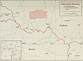
 DRC - S Sudan border map.png 1,204 × 838; 334 KB
-
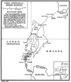 DRC-Rwanda border.png 835 × 962; 280 KB
-
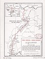
 DRC-Tanzania border.png 811 × 1,111; 282 KB
-
 DRC-Uganda border.jpg 795 × 1,046; 131 KB
-
 Sudan-Zaire Boundary.jpg 2,703 × 1,980; 1.53 MB


_boundary._LOC_85697535.jpg)


