Category:Maps of districts of Gujarat
States of India: Andhra Pradesh · Arunachal Pradesh · Assam · Bihar · Chhattisgarh · Goa · Gujarat · Haryana · Himachal Pradesh · Jharkhand · Karnataka · Kerala · Madhya Pradesh · Maharashtra · Manipur · Meghalaya · Mizoram · Nagaland · Odisha · Punjab · Rajasthan · Sikkim · Tamil Nadu · Telangana · Tripura · Uttar Pradesh · Uttarakhand · West Bengal
Union territories: Dadra and Nagar Haveli and Daman and Diu ·
Former states of India:
Former union territories:
Union territories: Dadra and Nagar Haveli and Daman and Diu ·
Former states of India:
Former union territories:

Subcategories
This category has only the following subcategory.
*
Media in category "Maps of districts of Gujarat"
The following 15 files are in this category, out of 15 total.
-
 Administrative map of Gujarat GU.png 2,170 × 1,722; 683 KB
-
 Administrative map of Gujarat with RTO codes for vehicle registration.png 3,014 × 2,391; 709 KB
-
 Administrative map of Gujarat.png 3,014 × 2,391; 660 KB
-
 Blank Map Gujarat state and districts.png 1,058 × 749; 135 KB
-
 Botad District Map.svg 2,006 × 2,358; 1.12 MB
-
 Gujarat district before 2013.png 1,058 × 749; 64 KB
-
 Gujarat districts.png 1,231 × 896; 656 KB
-
 India Gujarat districts 2011.png 1,503 × 1,210; 87 KB
-
 Map Gujarat state and districts.png 1,058 × 749; 65 KB
-
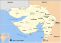
 Map GujDist Kuchchh.png 1,058 × 749; 63 KB
-
 Map GujDist North.png 1,058 × 749; 64 KB
-
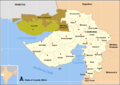
 Map GujDist Saurastra.png 1,058 × 749; 63 KB
-
 Map GujDist South.png 1,058 × 749; 63 KB
-
 Map of Gujarat districts.png 1,048 × 736; 48 KB
-
 Old District Map of Gujarat India in Gujarati.png 800 × 566; 151 KB


