Category:Maps of districts of Tamil Nadu
States of India: Andhra Pradesh · Arunachal Pradesh · Assam · Bihar · Chhattisgarh · Goa · Gujarat · Haryana · Himachal Pradesh · Jharkhand · Karnataka · Kerala · Madhya Pradesh · Maharashtra · Manipur · Meghalaya · Mizoram · Nagaland · Odisha · Punjab · Rajasthan · Sikkim · Tamil Nadu · Telangana · Tripura · Uttar Pradesh · Uttarakhand · West Bengal
Union territories: Dadra and Nagar Haveli and Daman and Diu ·
Former states of India:
Former union territories:
Union territories: Dadra and Nagar Haveli and Daman and Diu ·
Former states of India:
Former union territories:

Subcategories
This category has the following 2 subcategories, out of 2 total.
L
Media in category "Maps of districts of Tamil Nadu"
The following 20 files are in this category, out of 20 total.
-
 India Tamil Nadu districts numbered.svg 1,591 × 1,975; 383 KB
-
 Kallakurich 2.jpg 720 × 1,050; 49 KB
-
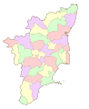 Map of Tamil Nadu districts.svg 1,668 × 2,032; 209 KB
-
 Tamil Nadu District Map (Tamil).png 3,333 × 4,138; 2.59 MB
-
 Tamil Nadu district map (Tamil).svg 1,640 × 2,032; 297 KB
-
 Tamil Nadu district map as.svg 1,640 × 2,032; 89 KB
-
 Tamil Nadu district map-gu.svg 1,640 × 2,032; 144 KB
-
 Tamil Nadu district map-kn.svg 1,640 × 2,032; 151 KB
-
 Tamil Nadu district map-ml.svg 1,640 × 2,032; 153 KB
-
 Tamil Nadu district map-mr.svg 1,640 × 2,032; 105 KB
-
 Tamil Nadu district map-pa.svg 1,640 × 2,032; 91 KB
-
 Tamil Nadu district map-te.svg 1,640 × 2,032; 80 KB
-
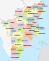
 Tamil Nadu district map.svg 1,640 × 2,032; 89 KB
-
 Tamil Nadu districts map.svg 512 × 636; 373 KB
-
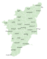
 Tamil Nadu districts.png 1,231 × 896; 149 KB
-
 Tamil Nadu map (Tamil).png 3,333 × 4,138; 2.55 MB
-
 Tamil Nadu map.png 800 × 992; 197 KB
-
 TamilNadu districts.jpg 352 × 417; 33 KB
-
 TamilNaduDistricts ByNumber.png 430 × 430; 13 KB
-
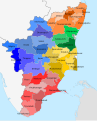
 TN Map Divison Wise.svg 512 × 636; 373 KB


.png)
.svg)


.png)


