Category:Maps of ethnic groups in Croatia
Subcategories
This category has the following 5 subcategories, out of 5 total.
Media in category "Maps of ethnic groups in Croatia"
The following 70 files are in this category, out of 70 total.
-
 12. Pakrac. Composición étnica 1991.png 960 × 720; 1.91 MB
-

-
 8.2a-Hungarian ethnic1495.png 2,112 × 1,379; 244 KB
-
 Banovina of Croatia religious map.png 2,608 × 2,809; 335 KB
-
 Croatia - ethnic 1900 with Serbian and Italian pretensions NDH.png 1,300 × 1,000; 578 KB
-
 Croatia - ethnic 1900 with Serbian and Italian pretensions.png 1,100 × 990; 559 KB
-
 Croatia-Croats-1953op.png 1,000 × 990; 333 KB
-
 Croatia-Croats-1953srez.png 1,000 × 990; 221 KB
-
 Croatia-Ethnic-1948.png 1,000 × 990; 465 KB
-
 Croatia-Ethnic-1953.png 1,000 × 990; 510 KB
-
 Croatia-Ethnic-1953op.png 1,000 × 990; 364 KB
-
 Croatia-Ethnic-1953op2.png 1,000 × 990; 335 KB
-
 Croatia-Ethnic-1953srez.png 1,000 × 990; 230 KB
-
 Croatia-Ethnic-1953srez2.png 1,000 × 990; 219 KB
-
 Croatia-Ethnic-1961.png 1,000 × 990; 510 KB
-
 Croatia-Ethnic-2001.png 1,000 × 990; 553 KB
-
 Croatia-Ethnic-2011.png 2,201 × 2,151; 266 KB
-
 Croatia-Slavonia ethnography 1910.jpg 1,000 × 561; 163 KB
-
 CroationPopulationChanges1981 2001.png 653 × 340; 73 KB
-
 Croats in eastern Croatia.jpg 1,176 × 740; 75 KB
-
 Croats in Osijek-Baranja County.jpg 739 × 478; 48 KB
-
 Croats in Vukovar-Syrmia County.jpg 757 × 490; 42 KB
-
 Dalmatia ethnic2001.png 1,096 × 982; 53 KB
-
 Dalmatia-1953-Ethnic.png 2,434 × 2,055; 64 KB
-
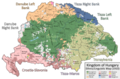 Ethnic Map of Hungary 1910 with Counties.png 6,208 × 4,104; 1.41 MB
-
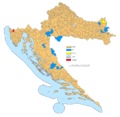
 Etnička karta RH.png 2,000 × 2,000; 223 KB
-
 HR-ethnic-BRA.png 638 × 443; 37 KB
-
 Hrvatskaetn.png 1,651 × 1,614; 142 KB
-
 Hrvatskaetno1991.pdf 1,239 × 1,754; 1.49 MB
-
 Hrvatskaetno2001.pdf 1,239 × 1,754; 1.67 MB
-
 Hrvatske etnije-ar.png 561 × 597; 30 KB
-
 Hrvatske etnije-de.png 546 × 600; 15 KB
-
 Hrvatske etnije-es.gif 800 × 600; 8 KB
-
 Hrvatske etnije.gif 561 × 597; 20 KB
-
 Hungarians in eastern Croatia.jpg 1,080 × 596; 120 KB
-
 Istria-Croats-1961.gif 640 × 786; 78 KB
-
 Istria-Croats-1971.gif 640 × 786; 79 KB
-
 Istria-Croats-1981.gif 640 × 786; 84 KB
-
 Istria-Croats-1991.gif 640 × 786; 95 KB
-
 Istria-Croats-2001.gif 640 × 786; 92 KB
-
 Istria-Ethnic-1961.gif 640 × 786; 91 KB
-
 Istria-Ethnic-1971.gif 640 × 786; 92 KB
-
 Istria-Ethnic-1981.gif 640 × 786; 83 KB
-
 Istria-Ethnic-1991.gif 640 × 786; 90 KB
-
 Istria-Ethnic-2001.gif 640 × 786; 88 KB
-
 Istria-Istrians-1991.gif 640 × 786; 99 KB
-
 Istria-Muslims-1991.gif 640 × 786; 81 KB
-
 Istria-Slovenians-1961.gif 640 × 786; 89 KB
-
 Istria-Slovenians-1971.gif 640 × 786; 90 KB
-
 Istria-Slovenians-1981.gif 640 × 786; 89 KB
-
 Istria-Slovenians-1991.gif 640 × 786; 90 KB
-
 Istria-Yugoslavs-1981.gif 640 × 786; 100 KB
-
 Istro-Romanian villages.png 2,902 × 3,138; 166 KB
-
 Jewish population in the Banovina of Croatia.svg 834 × 900; 3.03 MB
-
 Kingdom of Hungary - Ethnic Map - 1495.jpg 4,771 × 3,337; 11.96 MB
-
 Kingdom of Hungary - Ethnic Map - 1784.jpg 4,771 × 3,337; 11.87 MB
-
 Macedonians in Croatia.png 619 × 599; 78 KB
-
 Mađari u hrvatskoj.png 2,048 × 2,048; 767 KB
-
 Naselja Slavonija 17st.png 2,500 × 1,644; 148 KB
-
 NDH kotari.png 2,000 × 1,576; 142 KB
-
 NDH velikežupe.png 2,000 × 1,576; 133 KB
-
 Non-Croats in Slavonia (2011 Census).png 1,080 × 596; 49 KB
-
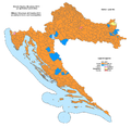
 Percentage of ethnic minorities in Croatian counties.svg 600 × 551; 833 KB
-
 Republika srpska krajina etnicka01.png 1,050 × 915; 88 KB
-
 Republika srpska krajina etnicka02.png 1,050 × 915; 77 KB
-
 Roma of Croatia 2011 census.jpg 2,201 × 2,151; 421 KB
-
 RomaniansInBalkans.png 1,451 × 1,655; 379 KB
-
 Slovaci v Chorvatsku.png 2,200 × 2,088; 270 KB
-
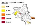 Slovaks of eastern Croatia 2011.jpg 866 × 674; 65 KB
-
 Ukrainians in Croatia 2011.gif 2,201 × 2,151; 127 KB


.png)


