Category:Maps of ethnic groups in Turkey
Countries of Asia: Afghanistan · Armenia‡ · Azerbaijan‡ · Cambodia · People's Republic of China · Cyprus‡ · Georgia‡ · India · Iran · Iraq · Israel · Kazakhstan‡ · Kyrgyzstan · Malaysia · Myanmar · Nepal · Pakistan · Russia‡ · Syria · Thailand · Turkey‡ · Uzbekistan · Vietnam · Yemen
Limited recognition: Abkhazia‡ · Taiwan
‡: partly located in Asia
Limited recognition: Abkhazia‡ · Taiwan
‡: partly located in Asia
Countries of Europe: Albania · Armenia‡ · Austria · Azerbaijan‡ · Belarus · Bosnia and Herzegovina · Bulgaria · Croatia · Cyprus‡ · Czech Republic · Estonia · Georgia‡ · Germany · Greece · Hungary · Italy · Kazakhstan‡ · Latvia · Lithuania · Moldova · Montenegro · Netherlands‡ · North Macedonia · Norway · Poland · Romania · Russia‡ · Serbia · Slovakia · Slovenia · Sweden · Turkey‡ · Ukraine · United Kingdom
Limited recognition: Abkhazia‡ · Kosovo · Transnistria
‡: partly located in Europe
Limited recognition: Abkhazia‡ · Kosovo · Transnistria
‡: partly located in Europe
Subcategories
This category has the following 5 subcategories, out of 5 total.
Media in category "Maps of ethnic groups in Turkey"
The following 36 files are in this category, out of 36 total.
-
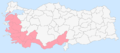
 Arabs in turkey.png 579 × 262; 9 KB
-
 Armenia in Paris Peace Conferance 1919 religion.png 708 × 444; 436 KB
-
 Armenian distribution map.png 1,880 × 921; 90 KB
-
 Crypto-Armenians in Turkey by provinces 2007.png 1,028 × 477; 45 KB
-
 Crypto-Armenians in Turkey by provinces 2007.svg 1,024 × 500; 517 KB
-
 DistributionOfArmeniansInTheCaucasus.png 1,167 × 884; 302 KB
-
 DistributionOfAzerbaijanisInCaucasusAndME.png 1,594 × 1,409; 297 KB
-
 Ethnic map of Asia Minor and Caucasus in 1914.jpg 1,270 × 795; 163 KB
-
 Ethnic map of turkey.jpg 2,560 × 1,577; 977 KB
-
 Ethnographic map of the Ardahan Okrug-1902.png 1,174 × 1,270; 1.95 MB
-
 Ethnographic map of the Kaghizman Okrug-1902.png 1,450 × 812; 1.61 MB
-
 Ethnographic map of the Kars Oblast (1902)-map legend-1.png 757 × 686; 433 KB
-
 Ethnographic map of the Kars Oblast (1902)-map legend-2.png 815 × 231; 153 KB
-
 Ethnographic map of the Kars Oblast-1902 - clipped.png 2,082 × 2,275; 5.31 MB
-
 Ethnographic map of the Kars Oblast-1902.png 4,956 × 3,361; 11.57 MB
-
 Ethnographic map of the Kars Okrug-1902.png 1,350 × 1,173; 2.35 MB
-
 Ethnographic map of the Oltu Okrug-1902.png 829 × 843; 985 KB
-
 Ethnolinguistic map of Turkey.jpg 1,023 × 652; 205 KB
-
 Georgian settlements renamed.png 1,280 × 625; 156 KB
-
 Gökçeada (İmroz) Etnik Haritası.png 1,200 × 626; 130 KB
-
 Hopa Hemshins map.png 1,292 × 919; 449 KB
-
 Jewish population Turkey 1965-01.svg 512 × 262; 642 KB
-
 Kurdish settlement.jpg 1,100 × 850; 437 KB
-
 Kurdish-inhabited areas of the Middle East and the Soviet Union in 1986.jpg 1,190 × 954; 288 KB
-
 Map of Armenian villages in the Samanli Dag region in 1914.png 1,174 × 526; 73 KB
-
 Map of ethnic Georgians significant distribution in Turkey.svg 550 × 325; 1.46 MB
-
 Settlements of Rize Province by ethnicity.png 964 × 940; 653 KB
-

-

-
 Tahtacıların yerleşim yerleri.png 1,281 × 880; 88 KB
-
 Tahtacıların Yerleşim İlleri.png 900 × 400; 126 KB
-
 Turkeyminorities.png 1,028 × 527; 40 KB
-
 Türkiyeetnikharitası.JPG 1,021 × 799; 215 KB
-
 Verbreitung der Muhacir und ethnischer Minderheiten in der Türkei.jpg 1,504 × 1,133; 585 KB
-
 Этнографическая карта Карсской области (1880 г.).jpg 1,711 × 1,768; 925 KB
-
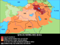 캅카스의아르메니아인분포도.png 1,167 × 884; 188 KB


-map_legend-1.png)


_Etnik_Haritas%C4%B1.png)


.jpg)

-map_legend-2.png)