Category:Maps of geologic formations in Newfoundland and Labrador
Subcategories
This category has the following 13 subcategories, out of 13 total.
M
Media in category "Maps of geologic formations in Newfoundland and Labrador"
The following 9 files are in this category, out of 9 total.
-
 Cinq Isles Formation map.svg 512 × 458; 26.2 MB
-
 Grand Beach Complex map.svg 512 × 458; 26.2 MB
-
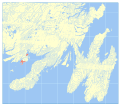
 Grandy's Pond formation map.svg 512 × 458; 26.4 MB
-
 Great Bay de l'Eau Formation map.svg 512 × 458; 26.23 MB
-
 Northwest Cove granite map.svg 512 × 458; 26.2 MB
-
 Pass Island Granite map.svg 512 × 458; 26.21 MB
-
 Pools Cove Formation map.svg 512 × 458; 26.23 MB
-
 Rocky Ridge Formation map.svg 512 × 458; 26.18 MB
-
 Wabana Group map.svg 512 × 786; 26.44 MB


