Category:Maps of the Afsharid Empire
Media in category "Maps of the Afsharid Empire"
The following 36 files are in this category, out of 36 total.
-
 1744 full afsharid map.png 1,920 × 1,080; 460 KB
-
 Afaharid Empire Map 1747.jpg 1,080 × 999; 258 KB
-
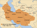
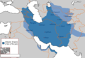
 Afsharid (1736-1802) pt.svg 420 × 325; 616 KB
-
 Afsharid (1736-1802)-ar.svg 420 × 325; 703 KB
-
 Afsharid (1736-1802)-cs.svg 420 × 325; 616 KB
-
 Afsharid (1736-1802)-de.svg 420 × 325; 612 KB
-
 Afsharid (1736-1802)-es.svg 420 × 325; 659 KB
-
 Afsharid (1736-1802)-fa.svg 420 × 325; 618 KB
-
 Afsharid (1736-1802)-he.svg 420 × 325; 616 KB
-
 Afsharid (1736-1802)-hu.svg 420 × 325; 659 KB
-
 Afsharid (1736-1802)-ru.svg 420 × 325; 616 KB
-
 Afsharid (1736-1802)-uk.svg 448 × 347; 658 KB
-
 Afsharid (1736-1802).svg 420 × 325; 616 KB
-
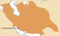
 Afsharid dynasty (greatest extent).svg 553 × 553; 273 KB
-
 Afsharid Dynasty 1736 - 1802 (AD).PNG 620 × 429; 20 KB
-
 Afsharid dynasty final stages.png 1,080 × 696; 26 KB
-
 Afsharid empire map.png 536 × 322; 20 KB
-
 Afsharid Iran 1741 wikimap.png 1,622 × 1,401; 61 KB
-
 Afsharid Iran 1741.png 1,622 × 1,401; 188 KB
-
 Afsharidempire.png 925 × 548; 30 KB
-
 AfsharidEmpireIran.png 1,094 × 700; 17 KB
-
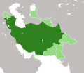
 AfsharidGreatestextentIranica.png 2,000 × 2,000; 733 KB
-
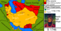
 Division of Afsharid empire.png 1,051 × 576; 54 KB
-
 Flag map of Afsharid Azerbaijan(fixed).png 727 × 689; 174 KB
-
 Flag-map of the Afsharid Empire.png 960 × 720; 176 KB
-
 Historical Atlas of Iran - Plate No. 22. (cropped).jpg 4,691 × 2,841; 1.87 MB
-
 Historical Atlas of Iran - Plate No. 22.jpg 4,963 × 3,509; 1.93 MB
-
 Iran-afsharids(1).jpg 3,621 × 3,045; 1.8 MB
-
 Map of the Afsharid Empire.png 620 × 428; 12 KB
-
 Mehmandust 001 (2).jpg 3,504 × 2,352; 1.68 MB
-
 Nadershah royal.png 804 × 434; 368 KB
-
 Persian Qajar Empire1808.jpg 467 × 378; 86 KB
-
 Revised Map of the Afsharid Empire.png 620 × 427; 26 KB
-
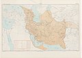
 Salmas in 1747 Emanuel Bowen Map of the "Persian Empire at the Time of Afsharid Dynasty".jpg 5,420 × 4,548; 8.66 MB
-
 Əfşar Map.png 1,920 × 999; 918 KB
-
 Əfşar map.png 1,920 × 1,080; 880 KB


_pt.svg)
-ar.svg)
-cs.svg)
-de.svg)
-es.svg)
-fa.svg)
-he.svg)
-hu.svg)
-ru.svg)
-uk.svg)
.svg)
.svg)
.PNG)


.png)

.jpg)

.jpg)

.jpg)


