Category:Maps of the Khwarazmian Empire
Media in category "Maps of the Khwarazmian Empire"
The following 18 files are in this category, out of 18 total.
-
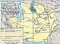
 Historical Atlas of Iran - Plate No. 16 (cropped).jpg 3,983 × 2,786; 1.86 MB
-
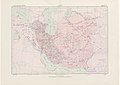 Historical Atlas of Iran - Plate No. 16.jpg 4,963 × 3,509; 2 MB
-
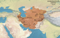
 Iran-kharazmshahids2.jpg 2,523 × 1,763; 1.4 MB
-
 Iszlám világ 1200k.jpg 2,339 × 1,654; 544 KB
-
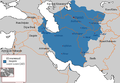
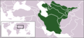
 Khwarazmian dynasty (greatest extent).svg 553 × 553; 273 KB
-
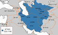
 Khwarezmian Empire 1190 - 1220 (AD)-ar.svg 652 × 407; 1.28 MB
-
 Khwarezmian Empire 1190 - 1220 (AD)-es.svg 1,801 × 1,373; 2.24 MB
-
 Khwarezmian Empire 1190 - 1220 (AD).PNG 620 × 428; 22 KB
-
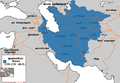
 Khwarezmian Empire 1190 - 1220 (AD).svg 652 × 407; 1.38 MB
-
 Khwarezmian Empire 1190 1220-ar.png 620 × 428; 49 KB
-
 Khwarezmian Empire 1190 1220-he.png 620 × 373; 30 KB
-
 Khwarezmian Empire 1190 1220.png 620 × 428; 30 KB
-
 Khwarezmid Empire 1190-1220.png 752 × 591; 38 KB
-
 Khwarezmid-empire-1220CE.png 250 × 114; 4 KB
-
 Map of the Khwarazmian Empire.png 3,370 × 2,175; 16 MB
-
 Империя Хорезмшахов.jpg 899 × 659; 244 KB
-
 الدولة الخوارزمية 2014-06-11 01-45.jpg 620 × 428; 70 KB
-
 குவாரசமியா.png 620 × 428; 65 KB
.jpg)


.svg)
-ar.svg)
-es.svg)
.PNG)
.svg)


