Category:Maps of the Arab-Israeli conflict
Wikimedia category | |||||
| Upload media | |||||
| Instance of | |||||
|---|---|---|---|---|---|
| |||||
| Category Maps of the Arab-Israeli conflict on sister projects: | |||||||||
|---|---|---|---|---|---|---|---|---|---|
Maps of the Arab-Israeli conflict
The overall wikimedia map index is at Category:Maps.
Subcategories
This category has the following 11 subcategories, out of 11 total.
1
2
- Maps of the Israel–Hamas war (47 F)
G
I
M
S
- Maps of the Six-Day War (62 F)
W
- Maps of the West Bank barrier (22 F)
Y
Media in category "Maps of the Arab-Israeli conflict"
The following 54 files are in this category, out of 54 total.
-
 Africa-Middle East Conflict.png 338 × 206; 7 KB
-
 AL and Israel.PNG 821 × 469; 31 KB
-
 Al Karamah Battle field.png 861 × 1,110; 1.43 MB
-
 Allon Plan-bn.svg 732 × 1,051; 211 KB
-
 Allon Plan.jpg 499 × 716; 56 KB
-
 Allon Plan.svg 732 × 1,051; 209 KB
-
 Alon plan.svg 512 × 589; 181 KB
-
 Arab Israeli Conflict - Tamil.png 1,090 × 582; 120 KB
-
 Arab Israeli Conflict 2.png 1,090 × 582; 100 KB
-
 Arab Israeli Conflict 5.png 1,090 × 582; 119 KB
-
 Arab-Israeli Conflict Key Players.svg 900 × 626; 431 KB
-
 Arab-Israeli Map.svg 512 × 299; 800 KB
-
 Arab-Israeli Map1.png 1,090 × 582; 115 KB
-
 Axes of Israeli Troop Attacks in the Course of the Lebanese Invasion.png 726 × 1,117; 248 KB
-
 BlueLine ver2.jpg 1,299 × 898; 238 KB
-
 BlueLine-ar.jpg 1,024 × 708; 226 KB
-
 BlueLine.jpg 1,299 × 898; 157 KB
-
 Disarmament Zones as of June 1998.png 590 × 487; 56 KB
-
 Faisal-Weizmann map.png 330 × 715; 36 KB
-
 Flotillagaza.png 1,148 × 879; 210 KB
-
 Ground force dispositions of the United Arab Republic (Egypt) as of 1 January 1967.png 1,578 × 1,210; 673 KB
-
 International views on Hamas.svg 2,754 × 1,398; 1.11 MB
-
 Israel 2004.png 700 × 1,506; 34 KB
-
 Israel and Arab states map k.png 336 × 188; 12 KB
-
 Israel and Arab states map n.png 336 × 188; 11 KB
-
 Israel and arab states map.png 336 × 188; 11 KB
-
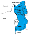
 Israel and the Disputed Territories map (cropped).png 1,350 × 1,317; 908 KB
-
 Israel and the Disputed Territories map.png 1,350 × 2,300; 1.39 MB
-
 Israel and the Disputed Territories map.svg 611 × 800; 1.36 MB
-
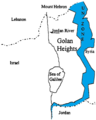
 Israel-Syria Early Warning Monitoring Stations.png 979 × 563; 34 KB
-
 Israelisettlementswestbank.jpg 314 × 383; 32 KB
-
 Kuwaiti Army In 1967 war (Arabic).jpg 1,006 × 780; 124 KB
-
 Libanoko gerra (1982-2000).jpg 579 × 872; 95 KB
-

-
 New Israel-Syria Disarmament Zones.png 635 × 464; 61 KB
-
 New UNDOF Boundary.png 552 × 667; 59 KB
-
 Palestine-Israel Historic Borders Over Time.png 4,849 × 2,156; 2.47 MB
-
 Projectwaw.org Israel in 1949.png 476 × 885; 216 KB
-
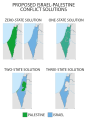 Proposed Israel-Palestine Conflict Solutions.svg 512 × 698; 374 KB
-
 Samaria, Jordan-Israel border.gif 1,704 × 1,506; 109 KB
-
 Six Day War Territories 2.png 398 × 599; 52 KB
-
 Soviet SAM Sites in Egypt as of May 1970 Top Secret CIA Estimate-ar.png 1,434 × 1,827; 436 KB
-
 Soviet SAM Sites in Egypt as of May 1970 Top Secret CIA Estimate.png 1,434 × 1,827; 216 KB
-
 State of Palestine Lands and Claims.png 2,000 × 2,000; 667 KB
-
 Three-state solution.png 600 × 900; 82 KB
-
 UNDOF Area of Operations.png 410 × 512; 35 KB
-
 UNESCO "Occupied Palestine Resolution" Votes.png 4,500 × 2,234; 272 KB
-

-
 UNRWA fields of operation map 2015.pdf 1,793 × 2,502; 806 KB
-
 UNRWA Fields of Operations Map 2017 hu.pdf 1,793 × 2,502; 558 KB
-
 UNRWA Fields of Operations Map 2017.pdf 1,793 × 2,502; 732 KB
-
 UNTSO map aug 2023.jpg 3,304 × 2,554; 950 KB
-
 UNTSO map feb 2011.jpg 2,688 × 3,464; 1.57 MB
-
 Zones contrôlées par le Yichouv au 20mai48.GIF 357 × 567; 26 KB


_as_of_1_January_1967.png)


.png)


.jpg)
.jpg)
.png)


