Category:Maps of the Polish-Lithuanian Commonwealth
Wikimedia category | |||||
| Upload media | |||||
| Instance of | |||||
|---|---|---|---|---|---|
| Category combines topics | |||||
| Polish–Lithuanian Commonwealth | |||||
historical multinational monarchist state in Central Europe (Crown of the Kingdom of Poland and the Grand Duchy of Lithuania) | |||||
| Instance of |
| ||||
| Capital | |||||
| Basic form of government |
| ||||
| Legislative body | |||||
| Official language | |||||
| Anthem |
| ||||
| Currency |
| ||||
| Has part(s) | |||||
| Inception |
| ||||
| Dissolved, abolished or demolished date |
| ||||
| Population |
| ||||
| Area |
| ||||
| Follows | |||||
| Replaces | |||||
| Different from | |||||
 | |||||
Subcategories
This category has the following 11 subcategories, out of 11 total.
*
M
N
S
Media in category "Maps of the Polish-Lithuanian Commonwealth"
The following 161 files are in this category, out of 161 total.
-
Irp1569.jpg 2,000 × 1,568; 1.09 MB
-
Polish-Lithuanian Commonwealth 1582.PNG 1,992 × 1,564; 708 KB
-
Polish-Swedish union 1592-1599.PNG 2,000 × 1,568; 859 KB
-
PolSwedU.JPG 2,000 × 1,568; 578 KB
-
Union personnelle de Suède Pologne.png 985 × 1,333; 121 KB
-
UPolSzwedz.JPG 2,000 × 1,568; 579 KB
-
Rzeczpospolita 1600.png 2,000 × 1,568; 329 KB
-
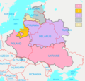
Polish-Lithuanian Commonwealth (1619) compared with today's borders (ENG).png 3,133 × 2,997; 173 KB
-
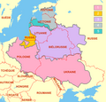
Polish-Lithuanian Commonwealth (1619) compared with today's borders FR.png 3,133 × 2,997; 304 KB
-
Polish-Lithuanian Commonwealth in 1619.PNG 1,996 × 1,558; 780 KB
-
Polish–Lithuanian Commonwealth 1619.png 3,133 × 2,997; 221 KB
-
Rzeczpospolita2nar.png 3,507 × 2,480; 1.08 MB
-
Irp.jpg 2,000 × 1,568; 613 KB
-
Irp1635.jpg 2,000 × 1,568; 616 KB
-
Polish-Lithuanian Commonwealth 1635.png 2,000 × 1,568; 852 KB
-
Unia polsko-litewska w 1635.png 765 × 600; 435 KB
-
Polish-Lithuanian Commonwealth in 1648.PNG 2,000 × 1,568; 804 KB
-
Polish-Russian war 1654-1667.PNG 2,000 × 1,568; 859 KB
-
Wojna polsko-rosyjska 1654-1667.PNG 2,000 × 1,568; 853 KB
-
Rzeczpospolita Trojga Narodów w roku 1658.jpg 2,000 × 1,568; 598 KB
-
Rzeczpospolita Trojga Narodów w roku 1658.png 2,000 × 1,568; 1.41 MB
-
Polish-Lithuanian Commonwealth in 1660.PNG 2,000 × 1,568; 1.03 MB
-
Polish-Lithuanian Commonwealth in 1672.png 1,986 × 1,566; 1,017 KB
-
Polish–Lithuanian Commonwealth as a fief of the Ottoman Empire 1672-1676.PNG 2,000 × 1,568; 754 KB
-
Baltikum 1686.png 885 × 700; 88 KB
-
Irp1686.png 1,996 × 1,470; 749 KB
-
RP 1686.JPG 2,000 × 1,568; 618 KB
-
Rp11686.jpg 2,000 × 1,568; 625 KB
-
Rzeczpospolita voivodships.png 2,000 × 1,568; 448 KB
-
Rzeczpospolita wojewodztwa.png 2,000 × 1,568; 421 KB
-
Rzeczpospolita.png 2,000 × 1,568; 332 KB
-
Польша-до-разделов.png 2,000 × 1,568; 115 KB
-
Great Northern War Part1.png 1,300 × 1,813; 3.49 MB
-
IRP.PNG 1,992 × 1,566; 922 KB
-
Irp1701.jpg 2,000 × 1,568; 558 KB
-
RP 1701.JPG 1,996 × 1,568; 560 KB
-
Great Northern War Part2.png 1,300 × 1,813; 3.4 MB
-
Poland1764physical.jpg 600 × 452; 329 KB
-
Polish-Lithuanian Commonwealth in 1764.PNG 2,000 × 1,568; 866 KB
-
1764 Ukraine.png 2,151 × 1,643; 1.99 MB
-
Bar Confederation 1768-1772.PNG 1,967 × 1,472; 810 KB
-
Congress Poland & Polish-Lithuanian Commonwealth (superimposed).png 1,900 × 1,554; 1.12 MB
-
Konfederacja barska 1768-1772.PNG 1,972 × 1,560; 855 KB
-
Polish-Lithuanian Commonwealth in 1772.PNG 1,894 × 1,552; 747 KB
-
Rzeczpospolita po I rozbiorze.png 1,590 × 1,568; 97 KB
-
Rzeczpospolita Rozbiory 1.png 2,000 × 1,568; 234 KB
-
Разделы-Польши1.png 2,000 × 1,568; 102 KB
-
Polish-Lithuanian Commonwealth 1773-1789.PNG 1,903 × 1,554; 783 KB
-
1788 Ukraine.png 1,985 × 1,539; 1.59 MB
-
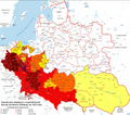
Population density of the Polish-Lithuanian Commonwealth according to the census in 1790.png 2,981 × 3,103; 1.46 MB
-
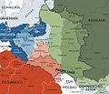
Karte polnischeteilungen4.jpg 1,344 × 1,149; 932 KB
-
Partitions of Poland.png 2,000 × 1,568; 261 KB
-
Rzeczpospolita Rozbiory 3.png 1,906 × 1,568; 325 KB
-
Administrative division of the Grand Duchy of Lithuania in half of XVI Century.PNG 1,269 × 1,089; 122 KB
-
Administrative Divisions of the Grand Duchy of Lithuania in 1654.png 4,039 × 3,316; 587 KB
-
Brama smolenska.jpg 2,394 × 1,756; 339 KB
-
Brama smoleńska Natanson-Leski.jpg 1,413 × 921; 445 KB
-
C. 1795 Poland and Lithuania (1569-1795).jpg 3,879 × 3,031; 3.8 MB
-
DuchyOfCourland.png 4,592 × 3,196; 580 KB
-
FileRzeczpospolita2narkor.png 1,957 × 1,539; 532 KB
-
Gran Guerra del Norte Fase1.png 1,300 × 1,813; 3.48 MB
-
Gran Guerra del Norte Fase2.png 1,300 × 1,813; 3.4 MB
-
Grande guerra norte 1705 1706.jpg 789 × 719; 156 KB
-
Great Northern War Baltic Theater.png 619 × 506; 483 KB
-
Grosser Nordischer Krieg Phase1.png 1,300 × 1,813; 3.5 MB
-
Grosser Nordischer Krieg Phase2.png 1,300 × 1,813; 3.41 MB
-
IRP1.png 1,992 × 1,566; 1.01 MB
-
IRPmagnates.PNG 2,000 × 1,568; 848 KB
-
IRPmagnates1.PNG 2,000 × 1,568; 850 KB
-
Karte polnischeteilungen4.png 701 × 600; 595 KB
-
Königsberg 1656.PNG 717 × 515; 39 KB
-
Livon-war-post 1583.png 2,461 × 2,825; 157 KB
-
Map of Reč Paspalitaja Abodvuch Narodaŭ (lang-be).png 1,973 × 1,556; 556 KB
-
Map of Russia's war with the Rzeczpospolita in 1792 (be-tarask).png 2,000 × 1,568; 364 KB
-
Meyers b13 s0173a.jpg 2,048 × 1,718; 713 KB
-
Nalyvaiko Uprising 1594-1596.PNG 1,998 × 1,568; 847 KB
-
Partitioned Poland & the 2nd Republic (1772-1939).png 1,906 × 1,518; 443 KB
-
Partitioned Poland & the 2nd Republic (Chełm Land, Ziemia chełmska).png 1,814 × 1,496; 441 KB
-
Partitioned Poland & the 2nd Republic.png 1,798 × 1,518; 433 KB
-
Partitions of Poland-ar.png 2,000 × 1,568; 242 KB
-
Polen-Litauen BV044859943.jpg 3,768 × 4,500; 2.79 MB
-
Polish-Lithuanian Commonwealth (1619) compared with today's borders (noname).png 3,133 × 2,997; 123 KB
-
Polish-Lithuanian Commonwealth (1619) compared with today's borders PL.png 3,133 × 2,997; 177 KB
-
Polish-Lithuanian Commonwealth (1619) vi.png 1,956 × 1,876; 576 KB
-
Polish-Lithuanian Commonwealth (1619) zh.png 1,957 × 1,539; 642 KB
-
Polish-Lithuanian Commonwealth (1619).png 1,957 × 1,539; 556 KB
-
Polish-Lithuanian commonwealth 1619 map.png 791 × 375; 41 KB
-
Polish-Lithuanian Commonwealth 1789-1792.PNG 1,989 × 1,554; 733 KB
-
Polish-Lithuanian Commonwealth ru (1619).PNG 1,973 × 1,556; 132 KB
-
Polish-Lithuanian Commonwealth1773-1789.png 1,992 × 1,554; 848 KB
-
Polish-Lithuanian-Commonwealth-1635-ru.png 2,000 × 1,568; 889 KB
-
PolishRuswar 1792.JPG 2,000 × 1,568; 415 KB
-
PolishRuswar1792.PNG 2,000 × 1,568; 921 KB
-
PolRuswar 1792.JPG 2,000 × 1,568; 335 KB
-
PolskaWazów.gif 468 × 401; 14 KB
-
PolskaXVIIwieku.gif 355 × 353; 9 KB
-
Powstanie Kosińskiego 11.JPG 2,000 × 1,568; 600 KB
-
Powstanie Kosińskiego.PNG 2,000 × 1,568; 3.01 MB
-
Prussia during the Second Northern War upright.PNG 716 × 1,620; 125 KB
-
Prussia during the Second Northern War.PNG 1,444 × 1,042; 123 KB
-
Prussia during the Second Northern War.png 1,081 × 1,040; 112 KB
-
Puola-Liettua.png 476 × 374; 10 KB
-
RawskieIRP.JPG 2,000 × 1,568; 604 KB
-
Review of reviews and world's work (1890) (14793347573).jpg 2,714 × 3,980; 1.47 MB
-
Rp 1794.jpg 1,084 × 1,358; 186 KB
-
Rp 1794n.jpg 1,084 × 1,358; 181 KB
-
Rp1794.jpg 1,084 × 1,358; 262 KB
-
Rpon1793wojew.png 1,524 × 1,372; 513 KB
-
Russisch-Polnischer Krieg von 1792 - Karte.png 2,000 × 1,568; 902 KB
-
Rzecz2nar.png 1,954 × 1,531; 727 KB
-
Rzeczpospolita 1600 hu.svg 2,667 × 2,091; 330 KB
-
Rzeczpospolita części składowe.png 3,535 × 3,103; 186 KB
-
Rzeczpospolita de.png 2,000 × 1,568; 326 KB
-
Rzeczpospolita Dymitriads.png 2,000 × 1,568; 273 KB
-
Rzeczpospolita Rozbiory 2.png 1,902 × 1,568; 296 KB
-
Rzeczpospolita Rozbiory 3 de.png 2,000 × 1,568; 293 KB
-
Rzeczpospolita voivodships-ar.png 2,000 × 1,568; 415 KB
-
Rzeczpospolita-ch.png 2,000 × 1,568; 453 KB
-
Rzeczpospolita-HE.png 2,000 × 1,568; 282 KB
-
Rzeczpospolita2nar ES.png 1,973 × 1,556; 614 KB
-
Rzeczpospolita2nar-he.png 1,973 × 1,556; 589 KB
-
Rzeczpospolita2nar.pt.png 1,973 × 1,556; 647 KB
-
Rzeczpospolitapodrozb.png 700 × 600; 247 KB
-
7yearswar.PNG 1,996 × 1,563; 908 KB
-
South Prussia 1795–1806 administrative map with departments, districts and all towns.jpg 3,000 × 2,225; 1.38 MB
-
Territorial changes of Poland 1655-de.png 850 × 700; 158 KB
-
Territorial changes of Poland 1655.jpg 850 × 700; 235 KB
-
Territorial changes of Poland 1686-HE.jpg 850 × 700; 185 KB
-
Territorial changes of Poland 1742.jpg 850 × 700; 205 KB
-
Territorial changes of Poland 1772.jpg 850 × 700; 200 KB
-
Territorial changes of Poland 1793.jpg 850 × 700; 184 KB
-
Traité de Varsovie (1705).png 1,110 × 1,600; 115 KB
-
Truce of Andrusovo 1667.PNG 2,000 × 1,568; 1,023 KB
-
Truce of Andrusovo Ukraine 1667.png 1,043 × 810; 227 KB
-
Truce of Deulino 1618-1619.PNG 2,000 × 1,568; 747 KB
-
Truce of Jam Zapolski 1582.PNG 2,000 × 1,568; 711 KB
-
Vedrosha battle 1500 location.jpg 480 × 480; 104 KB
-
Wielki Gościniec Litewski.png 1,347 × 1,218; 392 KB
-
Švedų tvanas ATR.svg 512 × 399; 1.09 MB
-
Гродна (2018). ГДГАМ. арта Рэчы Паспалітай.jpg 3,120 × 4,160; 1.72 MB
-
Київське воєводство - Річ посполита.jpg 2,000 × 1,564; 700 KB
-
Київське воєводство Річ посполита.png 2,000 × 1,564; 2.54 MB
-
Перша Новоросійська губернія.png 1,985 × 1,517; 1.88 MB
-
Разделы-Польши.gif 2,000 × 1,568; 140 KB
-
Разделы-Польши1 новые цвета.gif 2,000 × 1,568; 516 KB
-
Разделы-Польши2.png 2,000 × 1,568; 104 KB
-
Розподіл Польщі.jpg 2,000 × 1,568; 831 KB


