Category:Maps of the history of Cyprus
- Maps of the History of Cyprus.
Subcategories
This category has the following 11 subcategories, out of 11 total.
A
- Maps of ancient Cyprus (11 F)
B
C
M
- Maps of the Fifth Crusade (4 F)
- Maps of the Second Crusade (8 F)
- Maps of the Sixth Crusade (4 F)
- Maps of the Third Crusade (11 F)
O
- Maps of Operation Atilla (22 F)
Media in category "Maps of the history of Cyprus"
The following 97 files are in this category, out of 97 total.
-
 Asia minor 1140.jpg 1,078 × 1,164; 566 KB
-
 Mongol raids in Syria and Palestine 1260.svg 657 × 901; 316 KB
-

-
 Alter Orient 1300BC.svg 2,102 × 1,510; 4.71 MB
-
 Ancient Near East 1300BC.svg 2,102 × 1,510; 4.71 MB
-
 Antiquity mapa2.jpg 1,390 × 1,288; 466 KB
-
 Antoine Philippe Houze . L'Empire des Perses. 1844 (H).jpg 395 × 232; 20 KB
-
 Asia minor 1140-es.svg 932 × 1,008; 978 KB
-
 Asia Minor and the States of the Crusaders.jpg 1,200 × 1,282; 364 KB
-
 Asia Minor and the States of the Crusaders.svg 250 × 272; 651 KB
-

-
 C. 1097 Europe and Mediterranean Lands.jpg 1,752 × 1,375; 2.11 MB
-
 C. 1100 Eastern Roman Empire.jpg 1,859 × 1,395; 2.73 MB
-
 C. 1190 Europe and Mediterranean Lands.jpg 1,514 × 1,173; 2.42 MB
-
 C. 1210 Southeastern Europe and Asia Minor.jpg 4,000 × 3,000; 2.92 MB
-
 C. 1270 Europe (Southeastern).jpg 2,320 × 1,174; 1.83 MB
-
 C. 1330 Western Asia under Mongols.jpg 3,993 × 3,000; 3.93 MB
-
 C. 1355 Southeastern Europe.jpg 1,690 × 1,335; 1.37 MB
-
 C. 1360 Europe and Western Asia.jpg 2,112 × 1,365; 2.11 MB
-
 C. 1360 Europe.jpg 4,045 × 3,000; 3.9 MB
-
 C. 1481 Southeastern Europe Ottoman Empire.jpg 1,408 × 1,344; 1.01 MB
-
 Campaign of the Battle of Ain Jalut 1260-ru.svg 432 × 572; 60 KB
-
 CiliciaPrincipadoDeAntioquíaYCondadoDeTrípoli.svg 955 × 1,315; 180 KB
-
 Crusade states in levant.PNG 291 × 504; 14 KB
-
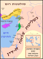
 Cyprus districts named he.PNG 630 × 420; 34 KB
-
 CyrpuswithArabic.png 800 × 508; 328 KB
-
 Eastern Mediterranean 1450- sr lat.svg 2,529 × 2,395; 453 KB
-
 Forteresses templières-es.svg 556 × 989; 231 KB
-
 Forteresses templières.png 552 × 986; 70 KB
-
 Forteresses templières.svg 556 × 989; 47 KB
-
 Heinrich Kiepert. Imperia Persarum et Macedonum. 1903 (IA).jpg 565 × 237; 105 KB
-
 Kingdom of Cyprus-es.svg 680 × 686; 704 KB
-
 Kingdom of Cyprus.png 596 × 678; 169 KB
-
 Map Crusader states 1102-es.svg 591 × 690; 359 KB
-
 Map Crusader states 1102-fr.svg 591 × 690; 118 KB
-
 Map Crusader states 1102-it.svg 591 × 690; 716 KB
-
 Map Crusader states 1102-pt.svg 591 × 690; 42 KB
-
 Map Crusader states 1135-ar.png 649 × 882; 174 KB
-
 Map Crusader states 1135-de2.svg 690 × 738; 563 KB
-
 Map Crusader states 1135-el.svg 978 × 1,330; 490 KB
-
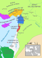
 Map Crusader states 1135-en.svg 955 × 1,315; 418 KB
-
 Map Crusader states 1135-eo.svg 978 × 1,330; 478 KB
-
 Map Crusader states 1135-es.svg 955 × 1,315; 428 KB
-
 Map Crusader states 1135-es2.svg 974 × 1,323; 293 KB
-
 Map Crusader states 1135-fr.svg 978 × 1,330; 582 KB
-
 Map Crusader states 1135-fr2.svg 744 × 921; 888 KB
-
 Map Crusader states 1135-hy.svg 978 × 1,330; 122 KB
-
 Map Crusader states 1135-it.png 978 × 1,330; 299 KB
-
 Map Crusader states 1135-mk.svg 955 × 1,315; 394 KB
-
 Map Crusader states 1135-nl.svg 978 × 1,330; 654 KB
-
 Map Crusader states 1135-pl.png 1,631 × 2,217; 632 KB
-
 Map Crusader states 1135-pl.svg 978 × 1,330; 570 KB
-
 Map Crusader states 1135-pt.svg 974 × 1,323; 119 KB
-
 Map Crusader states 1148-fa.svg 978 × 1,330; 385 KB
-
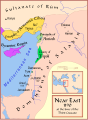
 Map Crusader states 1165-en.svg 955 × 1,315; 362 KB
-
 Map Crusader states 1165-es.svg 955 × 1,315; 662 KB
-
 Map Crusader states 1165-fa.svg 955 × 1,315; 308 KB
-
 Map Crusader states 1165-it.svg 955 × 1,315; 129 KB
-
 Map Crusader states 1165-pt.svg 955 × 1,315; 117 KB
-
 Map Crusader states 1190-ar.svg 978 × 1,330; 444 KB
-
 Map Crusader states 1190-arz.png 441 × 600; 68 KB
-
 Map Crusader states 1190-en.svg 978 × 1,330; 470 KB
-
 Map Crusader states 1190-es.svg 978 × 1,330; 185 KB
-
 Map Crusader states 1190-fa.svg 978 × 1,330; 323 KB
-
 Map Crusader states 1190-he.svg 978 × 1,330; 356 KB
-
 Map Crusader states 1190-it.png 978 × 1,330; 298 KB
-
 Map Crusader states 1190-it.svg 978 × 1,330; 591 KB
-
 Map Crusader states 1190-ka.png 978 × 1,330; 315 KB
-
 Map Crusader states 1190-pt.svg 978 × 1,330; 91 KB
-
 Map Crusader states 1190-ua.jpg 351 × 477; 159 KB
-
 Map Crusader states 1197-en.svg 507 × 690; 76 KB
-
 Map Crusader states 1197-es.svg 507 × 690; 114 KB
-
 Map Crusader states 1197-fr.svg 507 × 690; 596 KB
-
 Map Crusader states 1197-it.svg 507 × 690; 77 KB
-
 Map Crusader states 1197-ka.png 502 × 683; 104 KB
-
 Map Crusader states 1197-ru.svg 507 × 690; 76 KB
-
 Map Crusader states 1240-de.svg 507 × 690; 162 KB
-
 Map Crusader states 1240-eng.png 600 × 823; 110 KB
-
 Map Crusader states 1240-es.svg 507 × 690; 385 KB
-
 Map Crusader states 1240-fa.png 600 × 823; 117 KB
-
 Map Crusader states 1240-fr.svg 507 × 690; 636 KB
-
 Map Crusader states 1240-it.svg 507 × 690; 699 KB
-
 Map Crusader states 1240-pt.svg 507 × 690; 38 KB
-
 Map of ancient Cyprus.svg 4,527 × 2,317; 616 KB
-
 Map of Cyprus with Roman Cities.jpg 944 × 568; 174 KB
-
 Mongol raids in Syria and Palestine 1260-ar.svg 657 × 901; 318 KB
-
 Mongol raids in Syria and Palestine 1260-es.svg 657 × 901; 383 KB
-
 Mongol raids in Syria and Palestine 1260-he.svg 657 × 901; 272 KB
-
 Mongol raids in Syria and Palestine 1260-hu.svg 657 × 901; 210 KB
-
 Mongol raids in Syria and Palestine 1260-pt.svg 657 × 901; 173 KB
-
 Raids mongoli in Siria e Palestina-1260.it.svg 657 × 901; 434 KB
-
 Regions of Eastern Mediterranean and Southern Black Sea (1579) (cropped).jpg 5,951 × 2,960; 8.29 MB
-
 Regions of Eastern Mediterranean and Southern Black Sea (1579).jpg 5,951 × 4,139; 11.62 MB
-

-
 The Crusader States in 1135-gl.svg 966 × 1,322; 220 KB
-
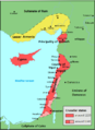
 Turkish Cypriot enclaves 1963-74.png 2,268 × 1,403; 1.87 MB
-
 فتوح مصر والنوبة.jpg 1,345 × 1,929; 695 KB


.jpg)


.jpg)


.jpg)


.jpg)


.jpg)


_(cropped).jpg)
.jpg)


.jpg)