Category:Maps of the world with cylindrical projection

"Cylindrical projections" are a large class of distinct projections, including equirectangular, Cassini, Mercator (and subtypes), central cylindrical, Gauss-Krüger, Gall, Miller cylindrical, Lambert cylindrical equal-area, Behrmann, Hobo-Dyer, Gall-Peters, and others. Please diffuse the files in this category to the proper subcategories.
Subcategories
This category has the following 3 subcategories, out of 3 total.
Media in category "Maps of the world with cylindrical projection"
The following 77 files are in this category, out of 77 total.
-

-
 1853 Kaei 6 Japanese Map of the World - Geographicus - ChikyuBankokuHozu-nakajima-1853.jpg 6,000 × 3,492; 5.51 MB
-
 2007-02-20 time zones A4 white bck.svg 840 × 494; 1.42 MB
-
 2007-02-20 time zones.svg 1,337 × 714; 2.49 MB
-
 2007-02-21 time zones-white.png 2,742 × 1,488; 367 KB
-
 2011-02 time zones.png 4,000 × 2,131; 2.2 MB
-
 AdmDiv2020.png 7,998 × 3,758; 1.21 MB
-
 Antipodas.jpg 1,424 × 914; 635 KB
-
 Antipodenkarte4.jpg 1,424 × 914; 209 KB
-
 Antipodes rect2160.png 2,160 × 1,080; 439 KB
-
 Antipodes rect4320.png 4,320 × 2,160; 1.03 MB
-
 Atlantic Ocean currents (Ocean currents 1943, cropped).png 416 × 246; 127 KB
-
 Biodiversity Hotspots 2015.svg 4,378 × 2,435; 742 KB
-
 Biodiversity Hotspots.svg 4,378 × 2,435; 758 KB
-
 Blank World Map.svg 643 × 331; 1.66 MB
-
 BlankMap-World-Flattened.svg 2,754 × 1,397; 1.68 MB
-
 BlueMarbleAntipoden.jpg 2,048 × 1,025; 447 KB
-
 Casowe pasma (2011).svg 840 × 494; 2.51 MB
-
 Cil-stereo.png 4,000 × 2,547; 722 KB
-
 Cylindrical Equal-Area Projection Oblique Case Map of the World.png 634 × 270; 46 KB
-
 Distribution of the Charadriidae.jpg 2,000 × 830; 772 KB
-
 Distribution of the familiy Charadriidae.jpg 2,000 × 1,000; 758 KB
-
 Earth rotation tangential speed.svg 512 × 384; 994 KB
-
 Equidistante cilinder projectie 60NB ZB.PNG 517 × 517; 30 KB
-
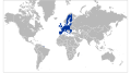 EU27-2007 world.svg 999 × 553; 560 KB
-
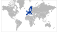 EU27-2008 as a single entity in the world.svg 999 × 553; 561 KB
-
 EU27-2012-states with applications-world.svg 999 × 553; 558 KB
-
 FPWorldMap Map.svg 3,000 × 1,700; 1.35 MB
-
 Global patterns of terrestrial vertebrate diversity - journal.pbio.1001294.g001.png 2,049 × 880; 1.25 MB
-
 Globale Präsenz von Brose.png 2,000 × 1,015; 285 KB
-
 Köppen-geiger-hessd-2007.svg 900 × 450; 4.53 MB
-
 Legume Biogeography.svg 4,378 × 2,435; 1.19 MB
-
 Location map of None.svg 800 × 400; 602 KB
-
 Mandatory bicycle helmet legislation.svg 512 × 227; 943 KB
-
 Mobildekning.JPG 800 × 369; 77 KB
-
 Mobildekning01.JPG 800 × 369; 80 KB
-
 NetzentwuerfeBehrmann.png 341 × 153; 153 KB
-
 Ocean currents 1943 (borderless).png 2,577 × 1,306; 2.75 MB
-
 Ocean currents 1943 (borderless)3.png 2,577 × 1,306; 2.41 MB
-
 Ocean currents 1943.jpg 2,639 × 1,406; 5.14 MB
-
 Ocean currents 1943.png 2,639 × 1,406; 4.89 MB
-
 Paises con solo un partido.png 6,904 × 3,640; 859 KB
-
 Paises con solo un partido.svg 2,754 × 1,397; 1.69 MB
-
 Plastic bag legislation.svg 1,035 × 531; 2.35 MB
-
 Polystyrene foam legislation.svg 1,035 × 531; 2.45 MB
-
 Regional powers of the World.svg 880 × 374; 1.21 MB
-
 Standard time zones of the world (2007-02-20, white bck).svg 1,371 × 744; 3.09 MB
-
 Standard time zones of the world.png 4,000 × 2,156; 2.49 MB
-
 Suisse bilan.svg 2,754 × 1,397; 2.2 MB
-
 Un-world.svg 729 × 371; 1.23 MB
-
 UTC hue4map X world flat6.svg 2,754 × 1,397; 1.68 MB
-
 VAAC Coverage.jpg 3,600 × 2,475; 1.76 MB
-
 W9 APB Stat map color.jpg 1,316 × 752; 80 KB
-
 Weltkarte Welt Auge Endfassung.jpg 5,906 × 3,232; 1.34 MB
-
 World - time zones map (2011).svg 512 × 273; 9.56 MB
-
 World - time zones map (2014).svg 512 × 276; 4.99 MB
-
 World borders cil hsi.png 4,000 × 1,278; 510 KB
-
 World cylindrical blank without 180.svg 1,260 × 630; 997 KB
-
 World cylindrical blank.svg 1,260 × 630; 995 KB
-
 World Heritage Sites by country (2006).gif 1,192 × 683; 113 KB
-
 World location map mono.svg 800 × 400; 530 KB
-
 World location map terr2015.svg 800 × 400; 569 KB
-
 World location map-mini.svg 800 × 400; 585 KB
-
 World map clip art.svg 1,052 × 744; 308 KB
-
 World Map from the Atlas of the USSR published in 1928.jpg 7,640 × 4,121; 15.66 MB
-
 World map nations mono.svg 1,024 × 512; 550 KB
-
 World map nations.svg 1,024 × 512; 521 KB
-
 World map with nations.svg 1,024 × 512; 586 KB
-
 World pacific centered.svg 1,266 × 616; 443 KB
-
 World-CIA WFB Map (2004).png 635 × 272; 27 KB
-
 World-lambert-cylindrical.png 800 × 254; 17 KB
-
 World.svg 1,280 × 651; 1.85 MB
-
 World2 rivers cities.svg 392 × 172; 1.42 MB
-
 World98+.svg 8,000 × 3,859; 15.93 MB
-
 World98.svg 8,000 × 3,859; 9.3 MB
-
 Worldmap wdb combined.svg 760 × 360; 897 KB
-
 WorldMapWithAntipodes.png 800 × 520; 340 KB
_-_Geographicus_-_GeoHydro-kircher-1665.jpg)


.png)


.svg)


.png)
3.png)


.svg)


.svg)
.svg)
.gif)


.png)


