Category:Maps showing 1775
| ← 1770 1771 1772 1774 1775 1776 1777 1778 1779→ |
English: Maps showing the year 1775 (i.e. history maps)
See also category: 1775 maps. and 1770s maps for more maps showing this year usually created not long after the given year.
See also category: 1775 maps. and 1770s maps for more maps showing this year usually created not long after the given year.
Media in category "Maps showing 1775"
The following 6 files are in this category, out of 6 total.
-
 1775 - Batalia de la Quebec - dispunerea forţelor.PNG 1,256 × 841; 399 KB
-
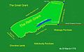
 1775 Watauga Grant.png 1,684 × 1,013; 930 KB
-
 Map of territorial growth 1775.svg 506 × 662; 507 KB
-
 Path Grant 8.15.13.jpg 1,565 × 961; 117 KB
-

-
 The magazine of American history with notes and queries (1877) (14784450352).jpg 3,424 × 2,032; 1.36 MB


_(14756894906).jpg)
_(14784450352).jpg)