Category:Maps showing 1819
| ← 1810 1811 1812 1813 1814 1815 1816 1817 1818 1819→ |
English: Maps showing the year 1819 (i.e. history maps)
See also category: 1819 maps. and 1810s maps for old maps created in this time.
See also category: 1819 maps. and 1810s maps for old maps created in this time.
Media in category "Maps showing 1819"
The following 5 files are in this category, out of 5 total.
-
 Flag map of the United States (1819).png 1,257 × 841; 54 KB
-
 Mapa de Venezuela 1817-1819.svg 1,664 × 1,483; 1.9 MB
-
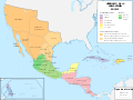 Mapa del Virreinato de la Nueva España (1819).svg 885 × 664; 1.06 MB
-
 United States 1819-03-1819-12.png 1,000 × 677; 110 KB
-
 United States 1819-12-1820.png 1,000 × 677; 109 KB
.png)

.svg)

