Category:Maps showing 1830
| ← 1830 1831 1832 1833 1834 1835 1836 1837 1838 → |
English: Maps showing the year 1830 (i.e. history maps)
See also category: 1830 maps. and 1830s maps for old maps created in this time.
See also category: 1830 maps. and 1830s maps for old maps created in this time.
Subcategories
This category has only the following subcategory.
Media in category "Maps showing 1830"
The following 4 files are in this category, out of 4 total.
-
 1DP Królestwa Polskiego 02-12-1830.jpg 1,592 × 908; 1.52 MB
-
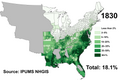 Black Americans 1830 County.png 13,100 × 8,800; 4.96 MB
-
 Dancing-Rabbit-Creek.png 812 × 1,218; 20 KB
-
 White Americans 1830 County.png 13,100 × 8,800; 4.91 MB


