Category:Maps showing 1837
| ← 1830 1831 1832 1833 1834 1835 1836 1837 1838 → |
English: Maps showing the year 1837 (i.e. history maps)
See also category: 1837 maps. and 1830s maps for old maps created in this time.
See also category: 1837 maps. and 1830s maps for old maps created in this time.
Media in category "Maps showing 1837"
The following 3 files are in this category, out of 3 total.
-
 Administrative Division of Rattanakosin Kingdom in 1837.jpg 10,000 × 15,000; 8.08 MB
-
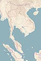 Map of Rattanakosin Kingdom in 1837.jpg 10,000 × 15,000; 5.67 MB
-
 United States 1837-01-1837-03.png 1,000 × 677; 109 KB


