Category:Maps showing 1930
| ← 1930 1931 1932 1933 1934 1935 1936 1937 1938 1939→ |
English: Maps showing the year 1930 (i.e. history maps)
See also category: 1930 maps. and 1930s maps for more maps showing this year usually created not long after the given year.
See also category: 1930 maps. and 1930s maps for more maps showing this year usually created not long after the given year.
Subcategories
This category has only the following subcategory.
Media in category "Maps showing 1930"
The following 18 files are in this category, out of 18 total.
-
 Flag-map of the world (1930).png 4,500 × 2,234; 581 KB
-
 Black Americans 1930 County.png 15,610 × 8,900; 11.49 MB
-
 China-Manchukuo-map-es.svg 1,262 × 900; 600 KB
-
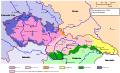 Czechoslovakia 1930 linguistic map - cz.svg 1,281 × 778; 771 KB
-
 Czechoslovakia 1930 linguistic map - en.svg 1,281 × 778; 802 KB
-
 Czechoslovakia 1930 linguistic map - es.svg 1,281 × 778; 753 KB
-
 Czechoslovakia 1930 linguistic map - hu.svg 1,281 × 778; 625 KB
-
 Czechoslovakia 1930 linguistic map - it.svg 1,281 × 778; 774 KB
-
 Czechoslovakia 1930 linguistic map - mk.svg 1,281 × 778; 751 KB
-

-

-
 Free City Danzig 1930.svg 450 × 456; 484 KB
-
 GuerraDeLasPlaniciesCentrales1930.svg 1,124 × 865; 567 KB
-
 Horn1930ad.png 1,110 × 1,327; 120 KB
-
 Non-Hispanic White Americans 1930 County.png 15,610 × 8,900; 15.94 MB
-
 Poland 1930.svg 450 × 456; 484 KB
-

-
 Weimar Republic 1930.svg 450 × 456; 483 KB
.png)


.jpg)
.jpg)


