Category:Maps showing 9th-century history
| Preceded by: 8th century maps |
9th century maps 801 AD-900 AD |
Succeeded by: 10th century maps |
Subcategories
This category has the following 21 subcategories, out of 21 total.
- Maps showing the 830s (2 F)
- Maps showing the 870s (4 F)
A
- Maps of 9th-century Arabia (1 F)
E
M
- Maps of the Samanid Empire (19 F)
- Maps showing 820 (7 F)
Media in category "Maps showing 9th-century history"
The following 90 files are in this category, out of 90 total.
-
 87EarlyBagratid884-962 (1).gif 700 × 457; 69 KB
-
 87EarlyBagratid884-962-pt.svg 512 × 330; 69 KB
-
 87EarlyBagratid884-962.gif 700 × 457; 62 KB
-
 Abass-will-007.png 1,002 × 745; 102 KB
-
 Adharbayjan Ninth Century.svg 900 × 675; 1.38 MB
-
 Aghlabids Dynasty 800 - 909 (AD).PNG 821 × 440; 35 KB
-
 Asser map.svg 1,210 × 586; 1.42 MB
-
 Atlas Hermann Haack.jpg 5,694 × 7,211; 6.2 MB
-
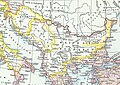 Balkans in 9th century.jpg 1,195 × 847; 339 KB
-
 Battle of Dayr al-'Aqul.svg 820 × 650; 884 KB
-
 Battle of the Mills-ar.svg 450 × 550; 544 KB
-
 Battle of the Mills.svg 450 × 550; 1.18 MB
-
 Battle of Vărbitsa Pass.png 1,722 × 1,952; 639 KB
-
 Borrell-es.svg 600 × 700; 532 KB
-
 Borrell.png 429 × 550; 31 KB
-
 British kingdoms c 800-fr.svg 672 × 1,190; 197 KB
-
 Bulgaria Simeon I (893-927)-ar.svg 752 × 719; 639 KB
-
 Bulgaria Simeon I (893-927)-zh.svg 752 × 719; 127 KB
-
 Bulgaria Simeon I (893-927).svg 752 × 719; 232 KB
-
 Bulgaria under Pressiyan Ier (836-852)-Fr.png 1,072 × 1,306; 578 KB
-
 Bulgaria under Pressiyan Ier (836-852)-Fr.svg 1,072 × 1,306; 619 KB
-
 Cambridge Medieval History V 3 (1922) (14579155857).jpg 2,906 × 2,156; 1.98 MB
-
 Carolingian empire 876-ru.svg 1,167 × 1,125; 153 KB
-

-
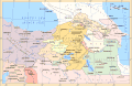
 Caucasus, 884-962.gif 700 × 473; 67 KB
-
 Central Abbasid Caliphate Ninth Century-ar.svg 760 × 600; 1,021 KB
-
 Central Abbasid Caliphate Ninth Century.svg 760 × 600; 995 KB
-
 Central europe 9th century-it.svg 425 × 338; 44 KB
-
 Central europe 9th century.png 700 × 528; 409 KB
-
 Central Europe at the time of the Carolingians (Putzger).jpg 3,476 × 2,814; 4.77 MB
-
 Central Europe in Carolingian times.jpg 3,234 × 2,865; 2.38 MB
-
 Coenwulf map.png 1,116 × 884; 521 KB
-
 Conquête musulmane de la Sicile au IXe siècle.svg 1,052 × 744; 3.82 MB
-
 Deling Prüm 855.png 512 × 464; 24 KB
-
 Droysens-21.jpg 8,816 × 5,775; 4.05 MB
-
 Droysens-21a.jpg 6,520 × 5,772; 3.9 MB
-
 Droysens-21b.jpg 2,128 × 2,752; 3.91 MB
-
 Droysens-21c.jpg 2,152 × 2,764; 4.16 MB
-
 EditedStattering.png 1,199 × 584; 34 KB
-
 Expansion of Rus.png 1,609 × 711; 188 KB
-
 Fuite du Peten au 9e siècle.jpg 3,072 × 2,287; 673 KB
-
 Great Moravia Puspoki's Theory.jpg 1,068 × 848; 960 KB
-
 Great moravia svatopluk datailed.png 852 × 603; 190 KB
-
 Great moravia svatopluk REAL.jpg 438 × 300; 85 KB
-
 Great moravia svatopluk.png 876 × 762; 223 KB
-
 Great moravia svatopluk.svg 1,251 × 901; 2.19 MB
-
 Great moravia vita.png 962 × 800; 439 KB
-
 Urbistumhildesheim.jpg 231 × 196; 20 KB
-
 History of Russia, IX-XV c.jpg 2,538 × 3,277; 1.4 MB
-
 Illas Britanicas (vèrs la fin dau sègle IX).png 801 × 956; 244 KB
-
 Iraq ca. 875.svg 700 × 650; 710 KB
-
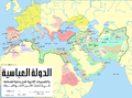
 Iraq Ninth Century-ar.svg 2,133 × 1,548; 14.64 MB
-
 Iraq Ninth Century-es.svg 2,133 × 1,548; 14.74 MB
-
 Iraq Ninth Century.png 550 × 400; 133 KB
-
 Karte Wikinger-Raubzüge im Rheinland.png 525 × 633; 323 KB
-
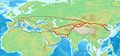
 Khurasan Road from al-Rayy to Naysabur.svg 1,000 × 480; 953 KB
-
 Khurasan Road from Baghdad to al-Rayy.svg 1,000 × 480; 1.32 MB
-
 Les pagis bourguignons au 9esiecle ru.svg 636 × 595; 342 KB
-
 Les pagis bourguignons au 9esiècle-uk.svg 664 × 690; 567 KB
-
 Levantine Ajnad.png 1,389 × 2,340; 783 KB
-
 Mihna Map.svg 1,960 × 1,200; 3.5 MB
-
 Mitteleuropa zur Zeit der Karolinger.jpg 4,301 × 2,842; 3.12 MB
-

-
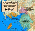 Northeast.Irish.Sea.Norse.placenames.jpg 1,005 × 897; 282 KB
-
 Offa dioceses.gif 670 × 566; 174 KB
-
 Radhanite1.jpg 800 × 376; 58 KB
-
 Radhanites2.png 1,201 × 601; 1.41 MB
-
 Rustamid Dynasty 776 - 909.jpg 1,596 × 1,080; 145 KB
-
 ShatteringA.png 1,199 × 584; 33 KB
-
 Skandinavische Ortsnamen in England.jpg 733 × 1,044; 395 KB
-
 Southeastern Europe, late 9th century.jpg 602 × 429; 365 KB
-
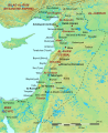
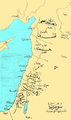
 Syria in the 9th century-ar.svg 422 × 516; 1.5 MB
-
 Syria in the 9th century-ar2.png 449 × 548; 380 KB
-
 Syria in the 9th century-es.svg 806 × 964; 1.04 MB
-
 Syria in the 9th century-pt.svg 450 × 550; 613 KB
-
 Syria in the 9th century.svg 431 × 521; 1.81 MB
-
 Territorial expansion during the reign of Khan Krum (803-814).png 1,596 × 1,498; 2.2 MB
-
 Territorial expansion during the reign of Khan Krum 803-814-es.svg 1,598 × 1,472; 2.32 MB
-
 Territory of the First Bulgarian Empire - 9 th century-cs.png 534 × 767; 365 KB
-
 Territory of the First Bulgarian Empire - 9 th century.png 973 × 1,397; 888 KB
-
 Uyghur empire-es.svg 865 × 674; 615 KB
-
 Uyghur empire.svg 865 × 674; 588 KB
-
 Versinikia.png 1,526 × 1,725; 609 KB
-
 Vertrag von Verdun und Ribemont.svg 890 × 890; 696 KB
-
 Wales 844-78 (Rhodri the Great) ru.svg 744 × 1,052; 458 KB
-
 Wales 844-78 (Rhodri the Great)-es.svg 744 × 1,052; 392 KB
-
 Wales 844-78 (Rhodri the Great).svg 744 × 1,052; 510 KB
-
 Wilayah Abbasiyyah semasa khalifah Harun al-Rashid.jpg 600 × 430; 92 KB
-
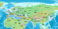
 World in 900 CE.png 4,000 × 2,036; 1.76 MB
-
 Zanj Rebellion.svg 900 × 720; 1.2 MB
.gif)


.PNG)


-ar.svg)
-zh.svg)
.svg)
-Fr.png)
-Fr.svg)
_(14579155857).jpg)

.png)


.jpg)


.png)


_(14591228967).jpg)


.png)


_ru.svg)
-es.svg)
.svg)


