Category:Maps showing history of the High Middle Ages
English: This category cross references all maps covering the historical era, the High Middle Ages. The purpose of this category is to provide narrower grouping of events, personages, and places into their more specific traditional third division of the overall Middle Ages. Some entities will necessarily span more than one of these categories. Roughly spans the years: 1000–1300 AD; (Capetian France and renewed Holy Roman Empire under Otto I to various events in the 1280–1290 time frame capped off by 1308 - Avignon Papacy established, which splits and weakens the Catholic church.
See also edit
Subcategories
This category has the following 7 subcategories, out of 7 total.
Media in category "Maps showing history of the High Middle Ages"
The following 59 files are in this category, out of 59 total.
-
 Angevindominionsfrommedandmodhismyers1905.jpg 2,256 × 3,615; 4.72 MB
-
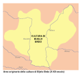 Bijelo Brdo Culture-it.svg 760 × 684; 92 KB
-
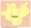
 Bijelo brdo culture01.png 1,048 × 937; 47 KB
-
 Bijelo brdo culture02.png 1,048 × 937; 47 KB
-
 Cambridge Medieval History V 3 (1922) (14579152517).jpg 4,864 × 6,604; 6.61 MB
-
 Cambridge Medieval History V 3 (1922) (14763258234).jpg 6,592 × 4,988; 5.48 MB
-
 Cambridge Medieval History V 3 (1922) (14763263634).jpg 4,760 × 3,034; 2.72 MB
-
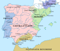
 CastillaLeon 1360-fr.svg 1,927 × 1,426; 406 KB
-
 Culture of Europe in 1250.png 572 × 387; 136 KB
-
 Cumania (1200) eng.png 1,141 × 500; 166 KB
-
 Cumania (1200) ukr.png 1,141 × 500; 142 KB
-
 Eastern Europe around 1250.jpg 2,049 × 1,621; 2.05 MB
-
 Europa w XII wieku (Ultima Thule).jpg 756 × 596; 151 KB
-
 Europe 1000.jpg 1,932 × 1,544; 689 KB
-
 Europe 1096-1254 - Religions - Arnaud de Vachon.png 1,254 × 936; 903 KB
-
 Europe 1142.jpg 1,327 × 959; 536 KB
-
 Europe About A.D. 1000.jpg 1,557 × 1,139; 461 KB
-

-
 Europe in the 14th Century.jpg 1,549 × 1,134; 620 KB
-
 Europe mainland d1097.JPG 938 × 600; 165 KB
-
 Europe mediterranean 1097.jpg 2,270 × 1,789; 4.85 MB
-
 Europe mediterranean 1190-ar.jpg 2,293 × 1,806; 1.34 MB
-
 Europevierge13e22.GIF 800 × 600; 28 KB
-
 Europevierge13e22.gif 800 × 600; 28 KB
-
 Franconia 1250 AD.png 1,670 × 1,428; 2.81 MB
-
 Friesische Seelande.png 1,191 × 666; 255 KB
-
 Frieslande.png 2,599 × 1,423; 280 KB
-
 Grafschaften Holstein Ratzeburg Schwerin Dannenberg Luechow 1250.png 700 × 796; 284 KB
-
 Grafschaften Holstein Ratzeburg Schwerin Dannenberg Luechow 1250.svg 700 × 794; 1.66 MB
-
 HRR 1250 (Duchy of Merania).jpg 1,785 × 2,391; 909 KB
-
 HRR 1250.jpg 7,189 × 11,212; 11.31 MB
-
 Hungary, Croatia, Bosnia and Galicia in the 12th century.jpg 1,983 × 1,614; 3.73 MB
-
 Johanniterorden Mitteleuropa 1300.png 2,500 × 2,167; 676 KB
-
 Joodse verhuizing binnen Europa.svg 570 × 400; 253 KB
-
 Karte Landgrafschaft Niederelsass 1250.png 1,215 × 1,503; 1.08 MB
-
 Kievan-rus-1015-1113-(en).png 2,166 × 2,659; 440 KB
-
 Kievan-rus-1015-1113-(hu).svg 2,166 × 2,659; 608 KB
-
 Lord Beckett.GIF 866 × 630; 37 KB
-
 Magyar vandorlas.gif 264 × 196; 11 KB
-
 Mapofrocheseterenglandfromfreemanswilliamrufus1882.jpg 4,934 × 2,670; 1.95 MB
-
 Mapofrocheseterenglandfromfreemanswilliamrufus1882e.jpg 4,934 × 2,670; 1.67 MB
-
 Public Schools Historical Atlas - England France 1152-1327.jpg 894 × 1,168; 321 KB
-
 Public Schools Historical Atlas - England France Henry I.jpg 863 × 1,116; 305 KB
-
 Public Schools Historical Atlas - Europe 1135.jpg 2,234 × 1,734; 1,013 KB
-
 Public Schools Historical Atlas - Europe 13th century.jpg 1,132 × 918; 374 KB
-
 Religions in southwestern Europe in 1050.jpg 1,398 × 1,374; 631 KB
-
 Rostov-Suzdal 1015-1113 (en).png 1,411 × 1,327; 69 KB
-
 Mapofrouennormandyfromfreemanswilliamrufus1882.jpg 2,655 × 4,789; 1.84 MB
-
 Rus de Kiev-1237.png 552 × 599; 343 KB
-
 Shepherd-byzanz 1000-enhanced 1-1900x1500.jpg 1,900 × 1,500; 941 KB
-
 Southeast Europe 1092.jpg 191 × 277; 45 KB
-
 Castilla 1210.png 600 × 643; 821 KB
-
 CastillaLeon 1360-es.svg 1,696 × 1,426; 913 KB
-
 CastillaLeon 1360-pt.svg 1,696 × 1,426; 1.04 MB
-
 CastillaLeon 1360.png 614 × 552; 702 KB
-
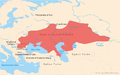 State of Cuman-Kipchak (13.) en.png 2,326 × 1,456; 623 KB
-
 State of Cuman-Kipchak (13.) tr.png 2,326 × 1,456; 548 KB
-
 State of Cuman-Kipchak ru.svg 744 × 466; 727 KB
-
 Sviatoslav1.png 886 × 578; 706 KB


_(14579152517).jpg)
_(14763258234).jpg)
_(14763263634).jpg)


_eng.png)
_ukr.png)

.jpg)


.jpg)


.jpg)


.png)
.svg)


.png)


_en.png)
_tr.png)

