Category:Maps showing the 1910s
| Maps showing the 20th century:
←1900s 1910s 1920s 1930s 1940s 1950s 1960s 1970s 1980s 1990s → |
Not to be confused with maps made in the 1910s.
Subcategories
This category has the following 12 subcategories, out of 12 total.
- Maps of the world in the 1910s (17 F)
Media in category "Maps showing the 1910s"
The following 6 files are in this category, out of 6 total.
-
 World 1914 empires colonies territory-HE.PNG 1,000 × 633; 29 KB
-
 Alash1917-1920.png 1,400 × 1,200; 98 KB
-
 European Russia Malaria Morbidity 1902-1911 - DPLA - d77145b38a34c36dc6cce62046fad9ef.jpg 2,752 × 4,414; 1.62 MB
-
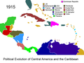 Political Evolution of Central America and the Caribbean 1915 na.png 1,000 × 750; 122 KB
-
 Монгол улсын 1911-1919 газрын зураг.jpg 3,543 × 2,234; 629 KB
-
 Монголын хошуудын зураг.jpg 11,111 × 5,549; 7.35 MB


