Category:Maps showing the Holy Roman Empire in 1618
Subcategories
This category has only the following subcategory.
Media in category "Maps showing the Holy Roman Empire in 1618"
The following 4 files are in this category, out of 4 total.
-
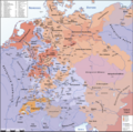
 HolyRomanEmpire 1618 russian.png 4,005 × 3,967; 3.41 MB
-
 HolyRomanEmpire 1618.png 4,005 × 3,964; 3.69 MB
-
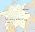
 Jülich-Kleve-Berg-Erbfolgestreit.svg 831 × 758; 810 KB
-
 Zacharias Fridenreich – Lebensstationen.svg 831 × 758; 812 KB


