Category:Maranathakerk, Rotterdam
| Object location | | View all coordinates using: OpenStreetMap |
|---|
Nederlands: Afbeeldingen van de Maranathakerk of Hillevlietkerk, Hillevliet 116, 3074 KD Rotterdam. Gelegen nabij de wijken Hillesluis en Bloemhof behorende tot het stadskwartier Feijenoord in de gemeente Rotterdam in de provincie Zuid-Holland in het westen van Nederland
Nederlands: Maranathakerk (Rotterdam), Hillesluis (wijk), Bloemhof (Rotterdam), Feijenoord (stadsdeel), Rotterdam, Zuid-Holland, Nederland
church building in Rotterdam, the Netherlands  | |||||
| Upload media | |||||
| Instance of | |||||
|---|---|---|---|---|---|
| Named after | |||||
| Location | Rotterdam, South Holland, Netherlands | ||||
| Street address |
| ||||
| Architectural style |
| ||||
| Architect | |||||
| Inception |
| ||||
| Religion or worldview | |||||
 | |||||
Media in category "Maranathakerk, Rotterdam"
The following 11 files are in this category, out of 11 total.
-
 Hillevlietkerk Rotterdam 01.jpg 3,872 × 2,592; 2.3 MB
-
 Hillevlietkerk Rotterdam 02.jpg 3,872 × 2,592; 2.33 MB
-
 Hillevlietkerk Rotterdam 03.jpg 2,592 × 3,872; 2.34 MB
-
 Hillevlietkerk Rotterdam 04.jpg 2,592 × 3,872; 2.36 MB
-
 Hillevlietkerk Rotterdam 05.jpg 3,872 × 2,592; 2.08 MB
-
 Hillevlietkerk Rotterdam 06.jpg 3,872 × 2,592; 2.42 MB
-
 Maranatha-kerk Hillevliet Rotterdam 001.jpg 393 × 501; 79 KB
-
 Maranathakerk Rotterdam Hillevliet - panoramio.jpg 538 × 996; 162 KB
-
 Rotterdam hillevliet kerk.jpg 1,564 × 2,200; 403 KB
-
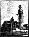
 Rotterdam Hillevliet-N.H.Maranathakerk zomer 1994.jpg 200 × 130; 6 KB
-
 Rotterdam Lange hilleweg Maranatha Kerk - panoramio.jpg 488 × 948; 311 KB


