Category:Marazion
town and civil parish in Cornwall, England  | |||||
| Upload media | |||||
| Instance of | |||||
|---|---|---|---|---|---|
| Location | Cornwall, South West England, England | ||||
| Population |
| ||||
| Said to be the same as | Marazion (Wikimedia duplicated page, civil parish) | ||||
| official website | |||||
 | |||||
Brezhoneg: Rummad:Kêrioù Kernev-Veur
Deutsch: Marazion ( kornisch: Marghasyow) ist eine Gemeinde und ein Ort im District Penwith der Grafschaft Cornwall in England. Der Ort liegt an der Mount's Bay, 2 km östlich von Penzance an der Great Western Railway. Bei Ebbe verbindet ein Damm die Insel St. Michael’s Mount mit Marazion.
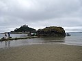
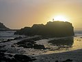
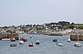
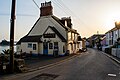
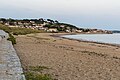
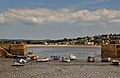
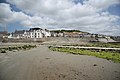
English: Marazion is a civil parish and town in Cornwall, England, UK. It lies on the shores of Mount's Bay, two miles east of Penzance, one mile east of the village of Long Rock, and is served by the Great Western Railway. A causeway passable at low tide unites Marazion with the otherwise insular St Michael's Mount. Marazion is a thriving tourist resort with an active artists' community who produce and sell paintings and pottery at numerous art galleries.
Kernowek: Marghasyow (po Marazion yn Sowsnek) yw tre vyghan yn ranndir Pennwydh yn Howlsedhes Kernow, Breten Veur. Nyns yw hi moy ages 3 km dhiworth Pennsans. Marghasyow o porth pyskek ha tre varghas yn termyn an Romanyon (hy hanow Latin o FORVM IOVIS). Wosa y's jevo hwath poesekter awos tyller pergherinses kentrevek, Karrek Loes y'n Koes (Sowsnek, St Michael's Mount). Yma'n hengov ma ow pesya y'n eur ma dre dornyaseth.
Subcategories
This category has the following 11 subcategories, out of 11 total.
B
H
M
- Marazion Cemetery (2 F)
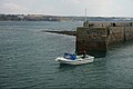
- Marazion harbour (4 F)
- Marazion Jubilee Gardens (6 F)
- Marazion Marsh Nature Reserve (30 F)
S
T
- Transport in Marazion (24 F)
V
- Views of St Michael's Mount (276 F)
W
Media in category "Marazion"
The following 200 files are in this category, out of 404 total.
(previous page) (next page)-
 A footpath off Virgin Hill - geograph.org.uk - 4060988.jpg 3,872 × 2,592; 4.87 MB
-
 A harvest of harebells^ - geograph.org.uk - 4060990.jpg 3,872 × 2,592; 3.4 MB
-

-

-
 Actually there's plenty of room - geograph.org.uk - 6120716.jpg 1,024 × 768; 167 KB
-
 All Saints Hall - geograph.org.uk - 6446185.jpg 1,024 × 681; 150 KB
-
 An intriguing chimney in Marazion - geograph.org.uk - 4877355.jpg 1,600 × 1,200; 350 KB
-
 Approaching roundabout near Goldsithney - geograph.org.uk - 4041472.jpg 640 × 387; 119 KB
-
 Around the Island event - geograph.org.uk - 6446228.jpg 1,024 × 681; 136 KB
-
 Arrival of St Michael's Mount amphibious vehicle - geograph.org.uk - 4307976.jpg 1,024 × 680; 265 KB
-
 Artillery motif on the former drill hall (geograph 4158821).jpg 1,600 × 1,064; 631 KB
-
 Balcony over Top Tieb Beach - geograph.org.uk - 3340621.jpg 640 × 480; 101 KB
-
 Beach Box Cafe - geograph.org.uk - 6446367.jpg 1,024 × 681; 81 KB
-
 Beacon Road, Marazion - geograph.org.uk - 3282254.jpg 857 × 1,142; 266 KB
-
 Blue015126.jpg 1,620 × 1,704; 327 KB
-
 Boat Landing at Marazion - panoramio.jpg 4,320 × 3,240; 2.72 MB
-
 Boat Landing for Mt St Michaels at Marazion - panoramio.jpg 4,320 × 3,240; 3.11 MB
-
 Boats at Marazion - geograph.org.uk - 2977740.jpg 800 × 600; 136 KB
-
 Burgee of Mount’s Bay Sailing Club.svg 1,800 × 1,200; 5 KB
-

-
 Bushes in the Red River Valley - geograph.org.uk - 5131468.jpg 640 × 426; 88 KB
-
 Cabbages with a view - geograph.org.uk - 5881922.jpg 4,896 × 3,672; 6.47 MB
-
 Car park, Fire Engine Inn, Marazion - geograph.org.uk - 5463588.jpg 640 × 480; 49 KB
-
 Cauliflower field near Venton Farm (7643).jpg 4,288 × 2,848; 6.34 MB
-
 Causeway from Chapel Rock, Marazion - geograph.org.uk - 5433343.jpg 1,024 × 683; 610 KB
-
 Causeway to St Michael's Mount - geograph.org.uk - 6438430.jpg 1,024 × 681; 200 KB
-
 Causeway to St Michael's Mount - geograph.org.uk - 6439121.jpg 1,024 × 681; 98 KB
-
 Cemetery in Marazion - geograph.org.uk - 4145964.jpg 3,872 × 2,592; 4.97 MB
-
 Cemetery with a view - geograph.org.uk - 5881915.jpg 4,896 × 3,672; 6.72 MB
-
 Chapel Rock (7450).jpg 4,288 × 2,848; 5.31 MB
-
 Chapel Rock - geograph.org.uk - 2528627.jpg 3,648 × 2,736; 2.01 MB
-
 Chapel Rock - geograph.org.uk - 5463624.jpg 640 × 480; 29 KB
-
 Chapel Rock - geograph.org.uk - 6438424.jpg 1,024 × 681; 129 KB
-
 Chapel Rock - geograph.org.uk - 6439124.jpg 1,024 × 681; 118 KB
-
 Chapel Rock - geograph.org.uk - 6446222.jpg 1,024 × 681; 104 KB
-
 Chapel Rock - Mount's Bay, Marazion - geograph.org.uk - 5186931.jpg 640 × 480; 43 KB
-
 Chapel Rock and St Michaels Mount - geograph.org.uk - 6446210.jpg 1,024 × 681; 99 KB
-
 Chapel Rock at Marazion - geograph.org.uk - 3288240.jpg 1,024 × 768; 103 KB
-
 Chapel Rock Cafe - geograph.org.uk - 6439174.jpg 1,024 × 681; 114 KB
-
 Chapel Rock, Marazion - geograph.org.uk - 6438839.jpg 2,000 × 1,035; 2.07 MB
-
 Chapel Rock, Marazion, Cornwall - geograph.org.uk - 3392521.jpg 4,000 × 2,666; 6.4 MB
-
 Chapel St - geograph.org.uk - 6443279.jpg 1,024 × 681; 199 KB
-
 Church of All Saints - altar - geograph.org.uk - 6443274.jpg 1,024 × 681; 123 KB
-
 Church of All Saints - font - geograph.org.uk - 6443267.jpg 681 × 1,024; 145 KB
-
 Church of All Saints - geograph.org.uk - 6443174.jpg 681 × 1,024; 149 KB
-
 Church of All Saints - geograph.org.uk - 6443251.jpg 1,024 × 681; 167 KB
-
 Church of All Saints - geograph.org.uk - 6443254.jpg 1,024 × 681; 182 KB
-
 Church of All Saints - geograph.org.uk - 6443259.jpg 681 × 1,024; 160 KB
-
 Church of All Saints - geograph.org.uk - 6443262.jpg 1,024 × 681; 195 KB
-
 Church of All Saints - geograph.org.uk - 6443270.jpg 1,024 × 681; 130 KB
-
 Church of All Saints - geograph.org.uk - 6443276.jpg 1,024 × 681; 126 KB
-
 Church of All Saints - geograph.org.uk - 6446194.jpg 681 × 1,024; 157 KB
-
 Church of All Saints - geograph.org.uk - 6446195.jpg 1,024 × 680; 165 KB
-
 Church of All Saints - geograph.org.uk - 6446199.jpg 1,024 × 681; 153 KB
-
 Church of All Saints - pulpit - geograph.org.uk - 6443271.jpg 1,024 × 681; 137 KB
-
 Church of All Saints, Marazion - geograph.org.uk - 5463593.jpg 640 × 480; 56 KB
-
 Chyvellan Cottage - geograph.org.uk - 5463573.jpg 640 × 480; 66 KB
-
 Cliffs east of Marazion (7636).jpg 4,288 × 2,848; 6.25 MB
-
 Clifftop field at Marazion - geograph.org.uk - 830511.jpg 640 × 480; 52 KB
-

-
 Coastline east of Marazion - geograph.org.uk - 3110593.jpg 640 × 427; 59 KB
-
 Coming across - geograph.org.uk - 3301850.jpg 1,600 × 1,045; 299 KB
-
 Commemorative stone - geograph.org.uk - 6443257.jpg 681 × 1,024; 254 KB
-
 Congestion on the Causeway - geograph.org.uk - 3263934.jpg 1,600 × 1,200; 628 KB
-
 Cordyline and St. Michael's Mount - geograph.org.uk - 389513.jpg 481 × 640; 57 KB
-
 Cornish flag and St Michael's Mount, Marazion, July 2021.jpg 3,024 × 4,032; 3.07 MB
-
 Cornish Kitchen - geograph.org.uk - 6438412.jpg 1,024 × 681; 139 KB
-
 Cornwall , St Michael's Mount - geograph.org.uk - 4607998.jpg 4,260 × 2,830; 4.89 MB
-
 Cornwall 2011 (6094225941).jpg 4,256 × 2,832; 1.94 MB
-
 Cornwall 2011 (6094226867).jpg 4,256 × 2,832; 1.54 MB
-
 Crossing to St Michael's Mount - geograph.org.uk - 2683850.jpg 640 × 414; 98 KB
-
 Cultivated field, Rose Hill, Marazion - geograph.org.uk - 6031529.jpg 3,264 × 2,448; 3.47 MB
-
 Cycle Route 3 alongside the A394 - geograph.org.uk - 5906232.jpg 4,896 × 3,672; 6.9 MB
-
 Cycle Route 3 as it diverges from the A394 - geograph.org.uk - 5906233.jpg 4,896 × 3,672; 6.81 MB
-
 Daffodils on the wide verge of the A394 near Goldsithney - geograph.org.uk - 4881170.jpg 1,600 × 1,200; 424 KB
-
 Dolphin Statue at Marazion - panoramio.jpg 4,320 × 3,240; 3.38 MB
-
 Dove Meadows Camping and Touring Site - geograph.org.uk - 4970951.jpg 4,608 × 3,456; 5.85 MB
-

-
 Ebenezer Cottage - geograph.org.uk - 6438401.jpg 1,024 × 681; 135 KB
-
 Ebenezer Methodist Chapel, Marazion - geograph.org.uk - 4878240.jpg 1,200 × 1,600; 289 KB
-

-
 Entering Marazion Harbour - geograph.org.uk - 6083234.jpg 3,598 × 2,399; 1.08 MB
-
 Fair Court, Marazion - geograph.org.uk - 5906240.jpg 4,896 × 3,672; 6.53 MB
-
 Farmland and coast east of Marazion - geograph.org.uk - 4972469.jpg 640 × 480; 88 KB
-
 Ferry Arriving at St.Michael's Mount - geograph.org.uk - 3403268.jpg 4,000 × 2,460; 6.49 MB
-
 Ferry Departing From St.Michael's Mount - geograph.org.uk - 3403258.jpg 4,000 × 2,666; 6.46 MB
-
 Ferry to St Michael's Mount - geograph.org.uk - 5186962.jpg 640 × 480; 59 KB
-
 Field Near Goldsithney - geograph.org.uk - 5835847.jpg 640 × 447; 41 KB
-
 Field of cabbages, Marazion - geograph.org.uk - 2095392.jpg 1,024 × 768; 296 KB
-
 Fields beside Gwallon Lane - geograph.org.uk - 3109742.jpg 640 × 427; 73 KB
-
 Fields near Tregurtha Downs - geograph.org.uk - 6651733.jpg 2,536 × 1,565; 1,001 KB
-
 Fields of winter cauliflowers - geograph.org.uk - 4146070.jpg 3,758 × 2,505; 3.96 MB
-
 Fields on edge of Marazion - geograph.org.uk - 4877350.jpg 1,600 × 1,196; 272 KB
-
 Follyfield Play Site - geograph.org.uk - 782154.jpg 640 × 480; 125 KB
-
 Footpath towards Trenow Farm - geograph.org.uk - 5881919.jpg 4,896 × 3,672; 7.49 MB
-
 Fore St - geograph.org.uk - 6443179.jpg 1,024 × 681; 115 KB
-
 Fore St - geograph.org.uk - 6443217.jpg 1,024 × 681; 163 KB
-
 Fore Street Marazion - geograph.org.uk - 4041469.jpg 640 × 408; 55 KB
-
 Fore Street, Marazion - geograph.org.uk - 4145630.jpg 3,872 × 2,592; 3.31 MB
-
 Fore Street, Marazion - geograph.org.uk - 6619721.jpg 3,648 × 1,744; 2.17 MB
-
 Free Methodist Chapel - geograph.org.uk - 6446360.jpg 1,024 × 681; 145 KB
-
 Free Methodist Church - geograph.org.uk - 6438406.jpg 1,024 × 681; 113 KB
-
 Gate Piers to Manor Office - geograph.org.uk - 6446361.jpg 1,024 × 681; 187 KB
-
 George V postbox on West End, Marazion - geograph.org.uk - 5465273.jpg 1,198 × 2,070; 483 KB
-
 Getting wet feet^ - geograph.org.uk - 6446216.jpg 1,024 × 681; 118 KB
-
 Gig racing - geograph.org.uk - 5473945.jpg 2,592 × 1,944; 1.57 MB
-
 Godolphin Arms - geograph.org.uk - 6438415.jpg 1,024 × 681; 137 KB
-
 Godolphin Arms - geograph.org.uk - 6439122.jpg 1,024 × 681; 139 KB
-
 Godolphin Drive - geograph.org.uk - 6438397.jpg 1,024 × 681; 149 KB
-
 Godolphin Drive, Marazion - geograph.org.uk - 5132690.jpg 640 × 480; 75 KB
-
 Grassland and woodland near the A394 - geograph.org.uk - 5463577.jpg 640 × 480; 55 KB
-
 Great Hogus - geograph.org.uk - 6438427.jpg 1,024 × 681; 77 KB
-
 Great Hogus - geograph.org.uk - 6446212.jpg 1,024 × 610; 103 KB
-
 Great Hogus, St. Michael's Mount - geograph.org.uk - 920592.jpg 640 × 352; 244 KB
-
 Gwallon Lane - geograph.org.uk - 5463576.jpg 640 × 480; 79 KB
-
 Harbour Mouth, St Michaels Mount - geograph.org.uk - 1540637.jpg 640 × 423; 57 KB
-
 Harvesting cauliflowers near Venton Farm (7644).jpg 4,288 × 2,848; 6.19 MB
-
 Higher Fore Street, Marazion - geograph.org.uk - 5463591.jpg 640 × 480; 49 KB
-
 Honeysuckle Cottage - geograph.org.uk - 6443240.jpg 1,024 × 671; 135 KB
-
 Horses being exercised on Marazion beach - geograph.org.uk - 4878178.jpg 1,600 × 1,200; 277 KB
-
 House on Market Place - geograph.org.uk - 6446197.jpg 1,024 × 681; 170 KB
-
 House on Trevenner Square, Marazion - geograph.org.uk - 5465264.jpg 640 × 480; 56 KB
-
 House on West End, Marazion - geograph.org.uk - 5465274.jpg 2,848 × 2,136; 1.48 MB
-
 Houses on Fore Street, Marazion - geograph.org.uk - 5465271.jpg 640 × 480; 75 KB
-
 Houses on Gwallon Lane, Marazion - geograph.org.uk - 5463581.jpg 640 × 480; 58 KB
-
 In the Pink - geograph.org.uk - 6439176.jpg 1,024 × 681; 100 KB
-
 Jetty at Marazion - geograph.org.uk - 2995750.jpg 600 × 800; 165 KB
-
 Junction on Cycleway 3 - geograph.org.uk - 5885604.jpg 4,896 × 3,672; 7.1 MB
-
 Leys Lane - geograph.org.uk - 6443184.jpg 1,024 × 681; 164 KB
-
 Little Hogus - geograph.org.uk - 6446213.jpg 1,024 × 681; 124 KB
-
 Longrock , Looking towards Penzance - geograph.org.uk - 2497187.jpg 4,254 × 2,796; 4.53 MB
-
 Looking towards Marazion and St Michael's Mount - geograph.org.uk - 6620162.jpg 4,118 × 2,237; 2.01 MB
-
 Marazion (2022-07-16) 002.jpg 5,568 × 3,712; 15.94 MB
-
 Marazion (2022-07-16) 005.jpg 5,568 × 3,712; 19.68 MB
-
 Marazion (2022-07-16) 006.jpg 5,568 × 3,712; 22.49 MB
-
 Marazion (2022-07-16) 007.jpg 5,568 × 3,712; 20.84 MB
-
 Marazion (2022-07-16) 008.jpg 3,712 × 5,568; 18.61 MB
-
 Marazion (2022-07-16) 009.jpg 5,568 × 3,712; 18.17 MB
-
 Marazion (2022-07-16) 011.jpg 5,568 × 3,712; 16.99 MB
-
 Marazion (2022-07-16) 012.jpg 5,568 × 3,712; 20.33 MB
-
 Marazion (2022-07-16) 013.jpg 5,568 × 3,712; 18.01 MB
-
 Marazion (2022-07-16) 015.jpg 5,568 × 3,712; 17.36 MB
-
 Marazion (2022-07-16) 016.jpg 3,712 × 5,568; 19.33 MB
-
 Marazion (2022-07-16) 017.jpg 5,568 × 3,712; 18.45 MB
-
 Marazion (2022-07-16) 020.jpg 5,568 × 3,712; 18.16 MB
-
 Marazion (2022-07-16) 021.jpg 5,568 × 3,712; 19.28 MB
-
 Marazion (2022-07-16) 022.jpg 5,568 × 3,712; 19.93 MB
-
 Marazion (2022-07-16) 023.jpg 5,568 × 3,712; 14.35 MB
-
 Marazion (2022-07-16) 024.jpg 5,568 × 3,712; 14.36 MB
-
 Marazion (2022-07-16) 026.jpg 5,568 × 3,712; 13.53 MB
-
 Marazion (2022-07-16) 027.jpg 3,712 × 5,568; 15.87 MB
-
 Marazion (2022-07-16) 034.jpg 3,712 × 5,568; 17.02 MB
-
 Marazion (2022-07-16) 039.jpg 3,712 × 5,568; 14.94 MB
-
 Marazion (2022-07-16) 047.jpg 3,712 × 5,568; 16.48 MB
-
 Marazion (2022-07-16) 048.jpg 3,712 × 5,568; 15.92 MB
-
 Marazion (2022-07-16) 051.jpg 3,712 × 5,568; 17.36 MB
-
 Marazion (2022-07-16) 052.jpg 5,568 × 3,712; 18.35 MB
-
 Marazion (2022-07-16) 053.jpg 5,568 × 3,712; 19.83 MB
-
 Marazion (2022-07-16) 054.jpg 5,568 × 3,712; 19.6 MB
-
 Marazion (2022-07-16) 055.jpg 3,712 × 5,568; 17.87 MB
-
 Marazion (2022-07-16) 056.jpg 5,568 × 3,712; 17.57 MB
-
 Marazion (2022-07-16) 057.jpg 3,712 × 5,568; 17.9 MB
-
 Marazion (2022-07-16) 058.jpg 5,568 × 3,712; 18.83 MB
-
 Marazion (2022-07-16) 059.jpg 5,568 × 3,712; 19.06 MB
-
 Marazion (2022-07-16) 060.jpg 5,568 × 3,712; 20.86 MB
-
 Marazion (2022-07-16) 068.jpg 5,568 × 3,712; 14.3 MB
-
 Marazion (2022-07-16) 076.jpg 5,568 × 3,712; 17.59 MB
-
 Marazion (2022-07-16) 081.jpg 5,568 × 3,712; 16.48 MB
-
 Marazion (2022-07-16) 082.jpg 5,568 × 3,712; 17.93 MB
-
 Marazion (2022-07-16) 084.jpg 5,568 × 3,712; 13.42 MB
-
 Marazion (2022-07-16) 089.jpg 5,568 × 3,712; 18.15 MB
-
 Marazion (2022-07-16) 090.jpg 5,568 × 3,712; 17 MB
-
 Marazion (2022-07-16) 100.jpg 5,568 × 3,712; 16.17 MB
-
 Marazion (2022-07-16) 101.jpg 3,712 × 5,568; 16.35 MB
-
 Marazion (2022-07-16) 102.jpg 3,712 × 5,568; 16.57 MB
-
 Marazion (2022-07-16) 114.jpg 5,568 × 3,712; 14.53 MB
-
 Marazion (2022-07-16) 122.jpg 5,568 × 3,712; 17 MB
-
 Marazion (2022-07-16) 123.jpg 5,568 × 3,712; 14.73 MB
-
 Marazion (2022-07-16) 125.jpg 5,568 × 3,712; 15.56 MB
-
 Marazion (2022-07-16) 126.jpg 5,568 × 3,712; 13.15 MB
-
 Marazion (2022-07-16) 128.jpg 5,568 × 3,712; 14.38 MB
-
 Marazion (new) Bridge.jpg 3,456 × 4,608; 4.01 MB
-
 Marazion , All Saints Church - geograph.org.uk - 5753173.jpg 6,000 × 4,000; 6.46 MB
-
 Marazion , Armed Forces Day Parade - geograph.org.uk - 2496493.jpg 4,288 × 2,848; 6.24 MB
-
 Marazion , Armed Forces Day Parade - geograph.org.uk - 2496496.jpg 3,960 × 2,630; 4.2 MB
-
 Marazion , blue sky and blue sea - geograph.org.uk - 2499613.jpg 4,288 × 2,848; 4.5 MB
-
 Marazion , Children's Play Area - geograph.org.uk - 2499618.jpg 4,288 × 2,846; 5.17 MB
-
 Marazion , Coastline ^ Seagulls - geograph.org.uk - 2499615.jpg 4,244 × 2,780; 4.08 MB
-
 Marazion , Ferry Jetty - geograph.org.uk - 4598996.jpg 4,197 × 2,788; 7.2 MB
-
 Marazion , Great Hogus Rocks - geograph.org.uk - 2497188.jpg 4,284 × 2,840; 4.52 MB
-
 Marazion , Market Place - geograph.org.uk - 4598998.jpg 4,288 × 2,848; 4.81 MB
-
 Marazion , Mounts Bay - geograph.org.uk - 4598995.jpg 4,029 × 2,676; 4.82 MB
-
 Marazion , St Michael's Mount at low tide - geograph.org.uk - 2499600.jpg 4,204 × 2,716; 4.02 MB
-
 Marazion , West End - geograph.org.uk - 4599000.jpg 4,288 × 2,848; 5.31 MB
-

-
 Marazion - drinking fountain.jpg 3,024 × 4,032; 4.25 MB
-
 Marazion - Fore Street post box.jpg 2,556 × 2,173; 1.37 MB
-
 Marazion - geograph.org.uk - 1849116.jpg 640 × 480; 110 KB
-
 Marazion - geograph.org.uk - 1994496.jpg 640 × 426; 72 KB
-
 Marazion - geograph.org.uk - 5662235.jpg 1,000 × 662; 620 KB


.jpg)


.jpg)


.jpg)


.jpg)


.jpg)
.jpg)


.jpg)


_002.jpg)
_005.jpg)
_006.jpg)
_007.jpg)
_008.jpg)
_009.jpg)
_011.jpg)
_012.jpg)
_013.jpg)
_015.jpg)
_016.jpg)
_017.jpg)
_020.jpg)
_021.jpg)
_022.jpg)
_023.jpg)
_024.jpg)
_026.jpg)
_027.jpg)
_034.jpg)
_039.jpg)
_047.jpg)
_048.jpg)
_051.jpg)
_052.jpg)
_053.jpg)
_054.jpg)
_055.jpg)
_056.jpg)
_057.jpg)
_058.jpg)
_059.jpg)
_060.jpg)
_068.jpg)
_076.jpg)
_081.jpg)
_082.jpg)
_084.jpg)
_089.jpg)
_090.jpg)
_100.jpg)
_101.jpg)
_102.jpg)
_114.jpg)
_122.jpg)
_123.jpg)
_125.jpg)
_126.jpg)
_128.jpg)
_Bridge.jpg)


