Category:Mather Avenue

Mather Avenue was constructed in the 1920s and runs from Rose Lane south to Liverpool South Parkway station. It was one of John Brodie's wide avenues with a central reservation along which trams ran.
Subcategories
This category has the following 8 subcategories, out of 8 total.
Media in category "Mather Avenue"
The following 14 files are in this category, out of 14 total.
-
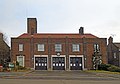 Allerton fire station 2016.jpg 4,744 × 3,320; 7.05 MB
-
 Allerton police station 2.jpg 4,736 × 3,256; 7.93 MB
-
 Allerton sign, Mather Avenue near Rose Lane.jpg 4,448 × 3,164; 7.96 MB
-
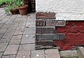
 Benchmark at 224 Mather Avenue.jpg 4,440 × 2,840; 9.9 MB
-
 Benchmark at 267 Mather Avenue.jpg 4,579 × 3,151; 7.71 MB
-
 Benchmark at 80 Mather Avenue.jpg 4,256 × 3,068; 10.04 MB
-
 Post box at Moorcroft Road.jpg 5,152 × 3,864; 7.37 MB
-
 Post box at Ballantrae Road.jpg 3,992 × 3,304; 5.59 MB
-
 Post box at Springwood Avenue - Mather Avenue.jpg 3,032 × 3,726; 6.4 MB
-
 Martins Bank, Mather Avenue.jpg 4,076 × 3,599; 8.76 MB
-
 Mather Avenue at Danefield Road. - geograph.org.uk - 1722511.jpg 640 × 480; 66 KB
-
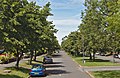 Mather Avenue north of Springwood Avenue.jpg 5,104 × 3,316; 23.68 MB
-
 Midland Bank, 30 Mather Avenue.jpg 4,714 × 3,621; 7.32 MB
-


.jpg)